Area Overview for East Sheen Ward
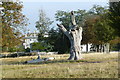
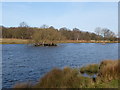
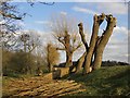
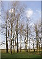
Photos of East Sheen Ward


Area Information
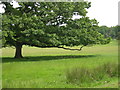
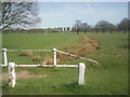
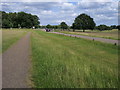
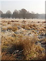
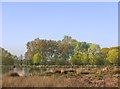
East Sheen Ward sits within the London Borough of Richmond upon Thames, occupying just 6.0 km² in southwest London. Centred around coordinates 51.451360212001326, -0.2645141183469918, this area forms part of the former Mortlake parish and historically belonged to Surrey. It is defined administratively as one of the wards surrounding Richmond Park, holding the largest share of the park among five nearby wards. This geographical relationship shapes daily life, offering immediate access to a major natural landmark. The area contains several listed buildings, including properties on Sheen Lane and Christ Church Road, reflecting its architectural history. Historical sites include the former Temple Grove estate, now residential, and churches like All Saints, which received its foundation stone in 1928. Living in East Sheen Ward means residing in a location with deep roots, first mentioned in the 13th century. Residents benefit from the presence of conservation areas and planning constraints that protect the neighbourhood's character. The ward sits among the green belt, ensuring that development is carefully managed. You move through an environment where historical significance meets modern suburban living. The area provides a distinct setting for those seeking stability and history combined with contemporary amenities.
- Area Type
- District Borough Unitary Ward
- Area Size
- 6.0 km²
- Population
- Not available
- Population Density
- Not available
Demographics
The community in East Sheen Ward reflects an older demographic profile. The median age for residents is 70 years, indicating a significant population of seniors. This aligns with the profile of a mature neighbourhood where many households have lived in the area for decades. Home ownership stands at 71%, which is markedly higher than the national average. This high rate suggests that most residents own their properties outright or have substantial equity. Such a figure indicates a stable community with fewer transient tenants. Households in the area tend to be larger or single-person elders rather than young families with children. Accommodation types vary, but the high ownership percentage dominates the social fabric. Diversity is present but underlying data groups specific ethnic and religious categories as total, meaning no single dominant minority group overshadows the majority. The area supports those who value quiet, long-term stability over rapid demographic turnover. Quality of life is supported by these figures, as owning your home typically reduces financial stress. Residents benefit from having secured accommodation in a region recognised for its safety and green spaces. The age profile means local businesses and services cater to an older clientele.
Household Size
Accommodation Type
Tenure
Ethnic Group
Religion
Household Composition
Age
Household Deprivation
NS-SEC
Explore more demographic insights in this area
Go to Demographics tabPlanning
Planning Constraints
- Flood RiskPremium
- Ramsar Wetland SitesPremium
- Area of Outstanding Natural BeautyPremium
- Protected Nature ReservePremium
- Protected WoodlandPremium
- Crime RiskPremium