Area Overview for East Putney Ward
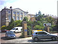
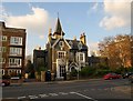
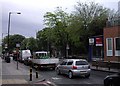
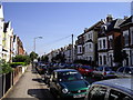
Photos of East Putney Ward


Area Information
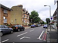
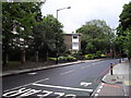
Living in East Putney Ward offers a distinct residential experience on the south side of London. This district comprises just 1.6 square kilometres, making it a compact yet dense community. You will find 3,251 residents living within these boundaries, resulting in a population density of 1,983 people per square kilometre. This figure places East Putney Ward among the more densely populated areas in the borough. The ward is situated within Richmond upon Thames, an affluent London borough known for its parks and heritage. Despite the high density, the area functions as a well-defined neighbourhood rather than being lost in a sprawling urban fabric. Daily life here revolves around a close-knit community structure where local services and amenities must be accessible due to the limited land available. Residents navigate a space that is fully built out with very little room for expansion. The scale of the ward suggests an environment where local interactions are frequent and the local footprint is significant. You are entering a shared space where the collective needs of over three thousand individuals shape the daily rhythm of the place. Prospective homebuyers should understand that property choices are constrained by this specific urban density. The area feels established and lived-in, reflecting a long history of settlement in the region. It is a place where you live immediately, without the prospect of future large-scale changes to the physical landscape.
- Area Type
- District Borough Unitary Ward
- Area Size
- 1.6 km²
- Population
- 3251
- Population Density
- 1983 people/km²
Demographics
The community profile in East Putney Ward is heavily skewed towards later life. The median age for residents is seventy years, which creates a notably older demographic compared to the national average. A majority of households consist primarily of older adults, defining the social fabric of the ward. This age profile suggests that daily life here caters specifically to the needs and routines of the elderly population. You will encounter a community where quiet lifestyles and established routines are the norm. Only 49 per cent of those living in East Putney Ward own their homes, meaning nearly half of the population rent their accommodation. This high proportion of renting implies that many residents rely on local social housing or private rentals rather than inheriting or purchasing property locally. With rents often high in this part of London, buying a home presents a significant financial hurdle for younger buyers. The household composition data confirms that the total population structure is dominated by the total age group statistic. There are no specific details provided on the breakdown of predominant ethnic groups or religious affiliations within the ward. Consequently, the demographic picture relies on the clear statistical evidence of age and ownership. Deprivation metrics are not explicitly listed in the available assessment scores, so you should base your expectations on the known age and ownership figures alone. The area is financially active, with a quarter of the population looking to rent, yet the overwhelming weight rests with the older demographic.
Household Size
Accommodation Type
Tenure
Ethnic Group
Religion
Household Composition
Age
Household Deprivation
NS-SEC
Explore more demographic insights in this area
Go to Demographics tabPlanning
Planning Constraints
- Flood RiskPremium
- Ramsar Wetland SitesPremium
- Area of Outstanding Natural BeautyPremium
- Protected Nature ReservePremium
- Protected WoodlandPremium
- Crime RiskPremium