Area Overview for East Barnet Ward
Photos of East Barnet Ward
Area Information
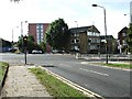
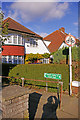
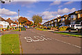
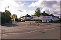
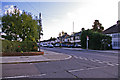
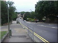
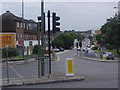
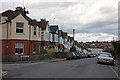
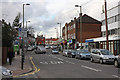
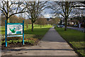
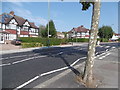
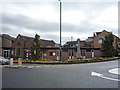
East Barnet Ward is an electoral ward within the London Borough of Barnet, sitting firmly in North London. It covers an area of 3.9 square kilometres and contains a population of 5,227 residents. This makes the ward a relatively compact residential pocket with a density of 1,348 people per square kilometre. The community has deep historical roots, tracing back to a wooded manor granted to the Abbey of St Albans in 1005. The area remained largely rural until the arrival of railways fundamentally changed its character. Oakleigh Park station opened in 1873, bringing train access to local residents. Later, the 1930s extension of the Piccadilly Line connected the neighbourhood directly to central London, accelerating the shift from woodland to suburb. Large houses were often replaced by schools, shops, and semi-detached or terraced homes to serve commuters working in the city. East Barnet School opened in 1937 and remains a significant local institution, having operated for over 80 years. Other notable educational sites include Church Hill School and St Mary's School. Historical estates such as Church Hill, Belmont, and Oakleigh Park still define the geography. Living in East Barnet Ward means inhabiting a space that has evolved over a millennium from an ancient manor to a functional suburban hub. The area now serves as a residential base for those seeking proximity to London while remaining part of the London Borough of Barnet's established fabric. Daily life here reflects a blend of historical continuity and modern suburban utility, anchored by robust transport links and long-standing community institutions.
- Area Type
- District Borough Unitary Ward
- Area Size
- 3.9 km²
- Population
- 5227
- Population Density
- 1348 people/km²
Demographics
The community profile of East Barnet Ward reveals an older demographic with a median age of 70 years. This indicates a neighbourhood composed principally of retired residents or long-term settled families. Over two-thirds of households, specifically 62%, report ownership of their homes. You are more likely to find owner-occupiers than tenants navigating this ward. The total household composition and accommodation type statistics suggest a stable population structure rather than a rapidly shifting transient community. There is no specific data provided regarding the breakdown of ethnic groups or religious affiliations within the total population. Similarly, detailed age range distributions beyond the median figure are not included in the current records. Despite the absence of granular ethnic or religious data, the area's history shows it was a woodland manor before becoming a commuter suburb. The high home ownership rate of 62% typically correlates with long-term settlement and local investment. The median age of 70 strongly suggests that many residents may be enjoying retirement within this 3.9 square kilometre footprint. This demographic profile often influences local spending habits and community engagement levels. With a population of 5,227 spread across this size, the environment retains a village-like feel despite being part of a larger borough. The lack of specific youth demographic data implies that families with young children may be less represented in the central wards compared to other London neighbourhoods. The overall picture points to a quiet, established community where home ownership is the norm and the population has settled over decades.
Household Size
Accommodation Type
Tenure
Ethnic Group
Religion
Household Composition
Age
Household Deprivation
NS-SEC
Explore more demographic insights in this area
Go to Demographics tabPlanning
Planning Constraints
- Flood RiskPremium
- Ramsar Wetland SitesPremium
- Area of Outstanding Natural BeautyPremium
- Protected Nature ReservePremium
- Protected WoodlandPremium