Area Overview for E9 7RX
Photos of E9 7RX


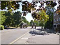
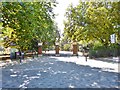
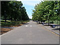


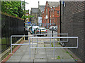
100 photos from this area
Area Information
Key information about the E9 7RX including its size, population, and administrative classification.
- Area Type
- Postcode
- Area Size
- 1.2 hectares
- Population
- 1205
- Population Density
- 16262 people/km²
House Prices in E9 7RX
54
Properties
£866,620
Average Sold Price
£140,000
Lowest Price
£2,200,000
Highest Price
Showing 54 properties
| Address | Type | Beds | Baths | Last Sale Price | Last Sale Date | |
|---|---|---|---|---|---|---|
| 44 Sharon Gardens, Hackney, London, E9 7RX | Semi-detached | 3 | 1 | £1,000,000 | Feb 2025 | |
| 42 Sharon Gardens, Hackney, London, E9 7RX | Detached | 4 | 3 | £2,200,000 | Mar 2024 | |
| 45 Sharon Gardens, Hackney, London, E9 7RX | Detached | 5 | 2 | £1,750,000 | Mar 2024 | |
| 11 Sharon Gardens, Hackney, London, E9 7RX | Semi-detached | 4 | 1 | £1,850,000 | Oct 2023 | |
| 28 Sharon Gardens, Hackney, London, E9 7RX | Semi-detached | 4 | 1 | £1,450,000 | Feb 2023 | |
| 36 Sharon Gardens, Hackney, London, E9 7RX | Terraced | 4 | - | £1,360,000 | Mar 2022 | |
| 19 Sharon Gardens, Hackney, London, E9 7RX | house | 3 | - | £1,750,000 | Jan 2022 | |
| 48 Sharon Gardens, Hackney, London, E9 7RX | house | - | - | £642,500 | Mar 2021 | |
| 7 Sharon Gardens, Hackney, London, E9 7RX | house | - | - | £1,000,000 | Sep 2020 | |
| 21 Sharon Gardens, Hackney, London, E9 7RX | Terraced | 4 | 2 | £1,220,000 | Mar 2020 |
Page 1 of 6
Energy Efficiency in E9 7RX
Amenities
Schools
| Rank | School | Type | Entry gender | Ages |
|---|
Explore more schools in this area
Go to Schools tabDemographics
Household Size
Family (3-5 people)
most common
Accommodation Type
Houses
most common
Tenure
31
majority
Ethnic Group
White
most common
Religion
N/A
most common
Household Composition
N/A
most common
Age
47
median
Adults (30-64 years)
most common
Household Deprivation
N/A
with no deprivation
NS-SEC
43
in Lower managerial occupations
Explore more demographic insights in this area
Go to Demographics tabPlanning
Planning Constraints
- Flood RiskPremium
- Ramsar Wetland SitesPremium
- Area of Outstanding Natural BeautyPremium
- Protected Nature ReservePremium
- Protected WoodlandPremium