Area Overview for E9 7HN
Photos of E9 7HN


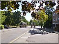
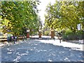
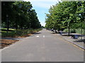
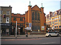

100 photos from this area
Area Information
Key information about the E9 7HN including its size, population, and administrative classification.
- Area Type
- Postcode
- Area Size
- 3.7 hectares
- Population
- 2561
- Population Density
- 4469 people/km²
House Prices in E9 7HN
68
Properties
£744,667
Average Sold Price
£127,000
Lowest Price
£2,140,000
Highest Price
Showing 68 properties
| Address | Type | Beds | Baths | Last Sale Price | Last Sale Date | |
|---|---|---|---|---|---|---|
| 47A Gore Road, Hackney, London, E9 7HN | Flat | - | - | £850,000 | Feb 2025 | |
| 79 Gore Road, Hackney, London, E9 7HN | Retail | 5 | 2 | £2,140,000 | Oct 2022 | |
| 56 Gore Road, Hackney, London, E9 7HN | Terraced | 4 | 1 | £1,300,000 | May 2016 | |
| 48A Gore Road, Hackney, London, E9 7HN | Flat | - | - | £315,000 | Jan 2006 | |
| 57 Gore Road, Hackney, London, E9 7HN | Terraced | - | - | £650,000 | Apr 2005 | |
| 78 Gore Road, Hackney, London, E9 7HN | house | - | - | £690,000 | Jul 2004 | |
| 53 Gore Road, Hackney, London, E9 7HN | Terraced | - | - | £450,000 | Jun 2001 | |
| 62 Gore Road, Hackney, London, E9 7HN | house | - | - | £127,000 | Feb 1997 | |
| 49 Gore Road, Hackney, London, E9 7HN | Terraced | - | - | £180,000 | Feb 1996 | |
| 55 Gore Road, Hackney, London, E9 7HN | Terraced | 4 | 1 | - | - |
Page 1 of 7
Energy Efficiency in E9 7HN
Amenities
Schools
| Rank | School | Type | Entry gender | Ages |
|---|
Explore more schools in this area
Go to Schools tabDemographics
Household Size
Family (3-5 people)
most common
Accommodation Type
Flats
most common
Tenure
43
majority
Ethnic Group
White
most common
Religion
N/A
most common
Household Composition
N/A
most common
Age
47
median
Adults (30-64 years)
most common
Household Deprivation
N/A
with no deprivation
NS-SEC
52
in Lower managerial occupations
Explore more demographic insights in this area
Go to Demographics tabPlanning
Planning Constraints
- Flood RiskPremium
- Ramsar Wetland SitesPremium
- Area of Outstanding Natural BeautyPremium
- Protected Nature ReservePremium
- Protected WoodlandPremium