Area Overview for E9 7EX
Photos of E9 7EX
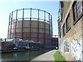
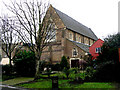
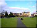
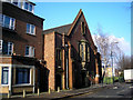
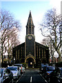
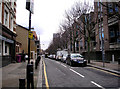
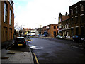


100 photos from this area
Area Information
Key information about the E9 7EX including its size, population, and administrative classification.
- Area Type
- Postcode
- Area Size
- 3296 m²
- Population
- 1446
- Population Density
- 12980 people/km²
House Prices in E9 7EX
17
Properties
£303,510
Average Sold Price
£49,500
Lowest Price
£825,000
Highest Price
Showing 17 properties
| Address | Type | Beds | Baths | Last Sale Price | Last Sale Date | |
|---|---|---|---|---|---|---|
| 15 Albert Close, Hackney, London, E9 7EX | Flat | 1 | 1 | £422,500 | Nov 2025 | |
| 29 Albert Close, Hackney, London, E9 7EX | house | - | - | £825,000 | Mar 2021 | |
| 1 Albert Close, Hackney, London, E9 7EX | Semi-detached | 3 | 1 | £710,000 | Aug 2018 | |
| 3 Albert Close, Hackney, London, E9 7EX | Terraced | 3 | 1 | £713,000 | Mar 2018 | |
| 7 Albert Close, Hackney, London, E9 7EX | house | - | - | £425,000 | Oct 2007 | |
| 17 Albert Close, Hackney, London, E9 7EX | Flat | - | - | £119,000 | Aug 2002 | |
| 31 Albert Close, Hackney, London, E9 7EX | house | - | - | £230,000 | May 2002 | |
| 13 Albert Close, Hackney, London, E9 7EX | house | 2 | - | £216,250 | Sep 2001 | |
| 9 Albert Close, Hackney, London, E9 7EX | Terraced | 2 | 1 | £175,000 | Jul 2001 | |
| 21 Albert Close, Hackney, London, E9 7EX | Flat | - | - | £72,950 | Oct 1999 |
Page 1 of 2
Energy Efficiency in E9 7EX
Amenities
Schools
| Rank | School | Type | Entry gender | Ages |
|---|
Explore more schools in this area
Go to Schools tabDemographics
Household Size
Two person
most common
Accommodation Type
Flats
most common
Tenure
38
majority
Ethnic Group
White
most common
Religion
N/A
most common
Household Composition
N/A
most common
Age
47
median
Adults (30-64 years)
most common
Household Deprivation
N/A
with no deprivation
NS-SEC
58
in Lower managerial occupations
Explore more demographic insights in this area
Go to Demographics tabPlanning
Planning Constraints
- Flood RiskPremium
- Ramsar Wetland SitesPremium
- Area of Outstanding Natural BeautyPremium
- Protected Nature ReservePremium
- Protected WoodlandPremium