Area Overview for E9 6NL
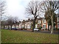
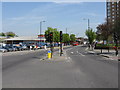
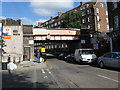
Photos of E9 6NL


Area Information
E9 6NL is a compact residential postcode in east London, home to 2,666 residents. The area’s small size means it is tightly clustered, with a population skewed toward adults aged 30–64, reflecting a mature community. Daily life here is shaped by proximity to essential services, with a mix of retail, transport, and educational hubs nearby. The area is not defined by sprawling estates but by a network of flats, which dominate the housing stock. While the community is relatively small, it benefits from strong connectivity to London’s transport arteries, including rail, metro, and ferry links. However, the area’s safety profile is mixed: while flood risk and environmental constraints are minimal, crime rates are notably high, with a safety score of 11 out of 100. This makes E9 6NL a location where convenience and accessibility are balanced against the need for vigilance. For buyers, the area’s compact nature means that proximity to amenities is a key feature, though the high crime risk may influence decision-making.
- Area Type
- Postcode
- Area Size
- Not available
- Population
- 2666
- Population Density
- 15375 people/km²
The property market in E9 6NL is characterised by a low rate of home ownership, with only 21% of residents owning their homes. This suggests that the area is primarily a rental market, with flats forming the majority of the housing stock. The prevalence of flats indicates a focus on high-density living, which is typical for urban postcodes. For buyers, this means that opportunities for purchase are limited, and the market is likely to be competitive. The small size of the area also means that property searches may extend to nearby zones, where similar housing types and rental dynamics may apply. The low home ownership rate could reflect broader trends in London, where affordability and housing supply constraints influence buyer behaviour.
House Prices in E9 6NL
No properties found in this postcode.
Energy Efficiency in E9 6NL
The lifestyle in E9 6NL is shaped by its proximity to a range of amenities. Retail options include Sainsburys Hackney, Iceland Hackney, and Tesco Hackney, providing everyday shopping convenience. Transport links are extensive, with rail, metro, ferry, and bus services ensuring easy access to London’s core and beyond. The area’s connectivity to London City Airport adds to its appeal for those requiring frequent travel. While the postcode itself is small, the surrounding area offers a network of leisure and practical facilities. The presence of multiple transport hubs and retail outlets means that daily errands and commutes are efficient. However, the area’s compact nature means that residents may need to venture slightly further for more specialised services or green spaces.
Amenities
Schools
Residents of E9 6NL have access to two notable schools within practical reach. Morningside Primary School, an outstanding Ofsted-rated institution, provides high-quality early education for younger children. For secondary education, The Urswick School – a Church of England secondary school – is rated good by Ofsted, offering a solid foundation for older students. The combination of a primary and secondary school within the area creates a seamless educational pathway for families. This mix ensures that children can transition smoothly from primary to secondary education without long commutes. The presence of well-rated schools is a significant draw for families, though the overall school landscape is limited to these two institutions.
| Rank | School | Type | Entry gender | Ages |
|---|
Explore more schools in this area
Go to Schools tabDemographics
The population of E9 6NL has a median age of 47, with the majority of residents falling within the 30–64 age range. This suggests a community of established professionals and families, rather than a transient or student population. Home ownership is relatively low at 21%, indicating that the area is more rental-focused than owner-occupied. The primary accommodation type is flats, which aligns with the compact nature of the postcode. The predominant ethnic group is White, though specific data on diversity beyond this is not provided. The demographic profile suggests a stable, middle-aged population with a focus on practical living arrangements. The absence of detailed deprivation data means that while the area’s age and housing profile are clear, broader socioeconomic factors remain unexplored.
Household Size
Accommodation Type
Tenure
Ethnic Group
Religion
Household Composition
Age
Household Deprivation
NS-SEC
Explore more demographic insights in this area
Go to Demographics tabPlanning
Planning Constraints
- Flood RiskPremium
- Ramsar Wetland SitesPremium
- Area of Outstanding Natural BeautyPremium
- Protected Nature ReservePremium
- Protected WoodlandPremium