Area Overview for E9 6EN
Photos of E9 6EN
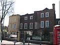

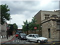
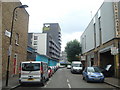
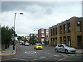


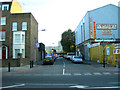

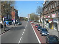

100 photos from this area
Area Information
Key information about the E9 6EN including its size, population, and administrative classification.
- Area Type
- Postcode
- Area Size
- Not available
- Population
- 1835
- Population Density
- 13653 people/km²
House Prices in E9 6EN
23
Properties
£307,500
Average Sold Price
£130,000
Lowest Price
£550,000
Highest Price
Showing 23 properties
| Address | Type | Beds | Baths | Last Sale Price | Last Sale Date | |
|---|---|---|---|---|---|---|
| 4 Tresham Walk, Hackney, London, E9 6EN | house | - | - | £527,500 | Jan 2021 | |
| 8 Tresham Walk, Hackney, London, E9 6EN | house | - | - | £550,000 | Jan 2021 | |
| 14 Tresham Walk, Hackney, London, E9 6EN | Terraced | 3 | 1 | £487,500 | Apr 2016 | |
| 6 Tresham Walk, Hackney, London, E9 6EN | Maisonette | 3 | 2 | £435,000 | Mar 2015 | |
| 2 Tresham Walk, Hackney, London, E9 6EN | house | 4 | 1 | £195,000 | Apr 2011 | |
| 9 Tresham Walk, Hackney, London, E9 6EN | Flat | - | - | £168,000 | Dec 2010 | |
| 10 Tresham Walk, Hackney, London, E9 6EN | Maisonette | 1 | 2 | £210,000 | Jan 2008 | |
| 16 Tresham Walk, Hackney, London, E9 6EN | Flat | - | - | £207,000 | Mar 2007 | |
| 20 Tresham Walk, Hackney, London, E9 6EN | Flat | - | - | £165,000 | May 2003 | |
| 22 Tresham Walk, Hackney, London, E9 6EN | Detached | 3 | 2 | £130,000 | Sep 2001 |
Page 1 of 3
Energy Efficiency in E9 6EN
Amenities
Schools
| Rank | School | Type | Entry gender | Ages |
|---|
Explore more schools in this area
Go to Schools tabDemographics
Household Size
One person
most common
Accommodation Type
Flats
most common
Tenure
25
majority
Ethnic Group
White
most common
Religion
N/A
most common
Household Composition
N/A
most common
Age
47
median
Adults (30-64 years)
most common
Household Deprivation
N/A
with no deprivation
NS-SEC
45
in Lower managerial occupations
Explore more demographic insights in this area
Go to Demographics tabPlanning
Planning Constraints
- Flood RiskPremium
- Ramsar Wetland SitesPremium
- Area of Outstanding Natural BeautyPremium
- Protected Nature ReservePremium
- Protected WoodlandPremium