Area Overview for E9 5JU
Photos of E9 5JU
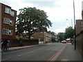


100 photos from this area
Area Information
Key information about the E9 5JU including its size, population, and administrative classification.
- Area Type
- Postcode
- Area Size
- 7.5 hectares
- Population
- 1210
- Population Density
- 2230 people/km²
House Prices in E9 5JU
82
Properties
£367,488
Average Sold Price
£185,000
Lowest Price
£625,000
Highest Price
Showing 82 properties
| Address | Type | Beds | Baths | Last Sale Price | Last Sale Date | |
|---|---|---|---|---|---|---|
| 82 Buxhall Crescent, Hackney, London, E9 5JU | Terraced | 3 | 1 | £625,000 | Sep 2025 | |
| 80 Buxhall Crescent, Hackney, London, E9 5JU | house | 3 | - | £459,950 | Apr 2015 | |
| 79 Buxhall Crescent, Hackney, London, E9 5JU | Terraced | 3 | 1 | £200,000 | Jun 2003 | |
| 78 Buxhall Crescent, Hackney, London, E9 5JU | Terraced | 3 | 2 | £185,000 | Jan 2003 | |
| 1 Buxhall Crescent, Hackney, London, E9 5JU | Terraced | 3 | 1 | - | - | |
| 65 Buxhall Crescent, Hackney, London, E9 5JU | Flat | - | - | - | - | |
| 56 Buxhall Crescent, Hackney, London, E9 5JU | house | - | - | - | - | |
| 58 Buxhall Crescent, Hackney, London, E9 5JU | house | - | - | - | - | |
| 2 Buxhall Crescent, Hackney, London, E9 5JU | house | - | - | - | - | |
| 28 Buxhall Crescent, Hackney, London, E9 5JU | Flat | - | - | - | - |
Page 1 of 9
Energy Efficiency in E9 5JU
Amenities
Schools
| Rank | School | Type | Entry gender | Ages |
|---|
Explore more schools in this area
Go to Schools tabDemographics
Household Size
One person
most common
Accommodation Type
Flats
most common
Tenure
22
majority
Ethnic Group
White
most common
Religion
N/A
most common
Household Composition
N/A
most common
Age
47
median
Adults (30-64 years)
most common
Household Deprivation
N/A
with no deprivation
NS-SEC
29
in Lower managerial occupations
Explore more demographic insights in this area
Go to Demographics tabPlanning
Planning Constraints
- Flood RiskPremium
- Ramsar Wetland SitesPremium
- Area of Outstanding Natural BeautyPremium
- Protected Nature ReservePremium
- Protected WoodlandPremium