Area Overview for E9 5ER
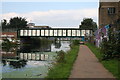
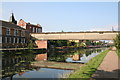
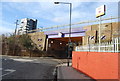
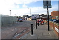
Photos of E9 5ER


Area Information
E9 5ER is a small, tightly packed residential area in east London, home to just over 1,000 people. Its compact size means it is not a sprawling suburb but a focused cluster of properties, likely centred around local amenities and transport hubs. The area’s population is predominantly adults aged 30–64, suggesting a mature community with established routines. Living here offers proximity to multiple rail and metro stations, including Hackney Wick and Stratford International, which connect residents to wider London. The broadband score is 100, ensuring seamless internet access, while mobile coverage is 85, a strong score for daily connectivity. However, the area’s crime risk is critical, with a safety score of 1/100, indicating higher-than-average incidents. Despite this, E9 5ER’s strategic location near retail outlets like Sainsburys Hackney and transport links to London City Airport makes it appealing for commuters and those prioritising convenience over tranquillity.
- Area Type
- Postcode
- Area Size
- Not available
- Population
- 1047
- Population Density
- 4838 people/km²
The property market in E9 5ER is heavily rental-oriented, with only 46% of homes owned by residents. The accommodation type is predominantly flats, which suggests a lack of detached or semi-detached housing stock. This makes the area more suited to renters or buyers seeking apartment living rather than family homes. The small population and compact nature of the area mean the housing stock is limited, potentially increasing competition among buyers. However, the absence of planning constraints such as protected woodlands or AONB designations may offer flexibility for future developments. For buyers, this area is likely to be a niche market, with properties focused on convenience rather than size or exclusivity. Proximity to transport links and retail hubs may offset the limitations of the housing stock for those prioritising location.
House Prices in E9 5ER
No properties found in this postcode.
Energy Efficiency in E9 5ER
Daily life in E9 5ER is shaped by its proximity to retail, transport, and leisure hubs. Residents have access to major supermarkets such as Sainsburys Hackney and Tesco Olympic, along with local co-ops like The Southern Co-operative. The area’s rail and metro stations, including Stratford High Street and Homerton, provide easy access to cultural and commercial centres. Ferry piers like Canary Wharf and East India offer waterfront connectivity, while London City Airport is within reach for frequent travellers. The presence of multiple transport options and retail outlets suggests a convenience-focused lifestyle, ideal for those prioritising accessibility over quiet living. However, the area’s small size means amenities are concentrated, requiring residents to navigate a compact network of services.
Amenities
Schools
| Rank | School | Type | Entry gender | Ages |
|---|
Explore more schools in this area
Go to Schools tabDemographics
The population of E9 5ER is 1,047, with a median age of 47. The majority of residents fall within the 30–64 age range, reflecting a community of working-age adults and older professionals. Home ownership is low at 46%, meaning nearly half of residents rent their homes. The area is characterised by flats, which dominate the accommodation type, suggesting a focus on high-density living. The predominant ethnic group is White, though specific data on diversity is not provided. The age profile and ownership statistics indicate a population that may be more transient or rental-focused, with limited data on deprivation levels. This demographic structure could influence local services and community dynamics, with a focus on accessibility and affordability over long-term residency.
Household Size
Accommodation Type
Tenure
Ethnic Group
Religion
Household Composition
Age
Household Deprivation
NS-SEC
Explore more demographic insights in this area
Go to Demographics tabPlanning
Planning Constraints
- Flood RiskPremium
- Ramsar Wetland SitesPremium
- Area of Outstanding Natural BeautyPremium
- Protected Nature ReservePremium
- Protected WoodlandPremium