Area Overview for E7 9QD
Photos of E7 9QD
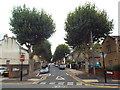
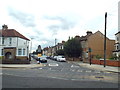
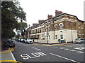
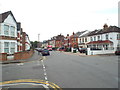
59 photos from this area
Area Information
Key information about the E7 9QD including its size, population, and administrative classification.
- Area Type
- Postcode
- Area Size
- 1.7 hectares
- Population
- 2549
- Population Density
- 13478 people/km²
House Prices in E7 9QD
13
Properties
£179,000
Average Sold Price
£59,000
Lowest Price
£462,500
Highest Price
Showing 13 properties
| Address | Type | Beds | Baths | Last Sale Price | Last Sale Date | |
|---|---|---|---|---|---|---|
| 61 Boleyn Road, Forest Gate, London, E7 9QD | house | 3 | 1 | £462,500 | Jan 2017 | |
| 71 Boleyn Road, Forest Gate, London, E7 9QD | Terraced | 3 | - | £220,000 | May 2005 | |
| 65 Boleyn Road, Forest Gate, London, E7 9QD | Terraced | - | - | £90,000 | Sep 2002 | |
| 69 Boleyn Road, Forest Gate, London, E7 9QD | Terraced | 4 | 2 | £59,000 | Sep 1999 | |
| 63 Boleyn Road, Forest Gate, London, E7 9QD | house | - | - | £63,500 | May 1997 | |
| 75A Boleyn Road, Forest Gate, London, E7 9QD | Detached | 3 | - | - | - | |
| 75B Boleyn Road, Forest Gate, London, E7 9QD | Terraced | 5 | - | - | - | |
| St Bonaventures Catholic Comprehensive School, Boleyn Road, Forest Gate, London, E7 9QD | commercial | - | - | - | - | |
| 73 Boleyn Road, Forest Gate, London, E7 9QD | house | - | - | - | - | |
| 67 Boleyn Road, Forest Gate, London, E7 9QD | Terraced | - | - | - | - |
Page 1 of 2
Energy Efficiency in E7 9QD
Amenities
Schools
| Rank | School | Type | Entry gender | Ages |
|---|
Explore more schools in this area
Go to Schools tabDemographics
Household Size
Family (3-5 people)
most common
Accommodation Type
Houses
most common
Tenure
38
majority
Ethnic Group
asian_total
most common
Religion
N/A
most common
Household Composition
N/A
most common
Age
47
median
Adults (30-64 years)
most common
Household Deprivation
N/A
with no deprivation
NS-SEC
20
in Lower managerial occupations
Explore more demographic insights in this area
Go to Demographics tabPlanning
Planning Constraints
- Flood RiskPremium
- Ramsar Wetland SitesPremium
- Area of Outstanding Natural BeautyPremium
- Protected Nature ReservePremium
- Protected WoodlandPremium