Area Overview for E7 9LH
Photos of E7 9LH


Area Information
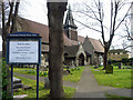
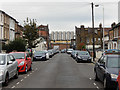
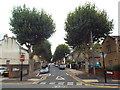
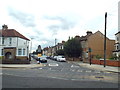
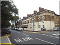
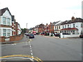
E7 9LH is a small residential postcode area in East London, nestled within the Forest Gate district of Newham. With a population of 1,830, it reflects a compact, tightly knit community characterised by Victorian terraced houses and brick-built flats. Historically part of the West Ham borough, the area evolved from 19th-century developments like the Gurney Estate and Woodgrange, which combined middle-class housing with early garden suburb concepts. Today, E7 9LH balances urban convenience with pockets of historic charm, including conservation areas and small parks. Residents benefit from proximity to major transport hubs, including Forest Gate Station and London City Airport, while the area’s low crime risk and flood safety scores make it an appealing choice for families and professionals. The mix of retail, rail, and ferry access ensures daily life is efficient, with shops like Sainsburys Stratford and transport links to central London just a short journey away.
- Area Type
- Postcode
- Area Size
- Not available
- Population
- 1830
- Population Density
- 19172 people/km²
E7 9LH is predominantly a rental market, with only 27% of homes owned by residents. The accommodation type is largely flats, reflecting a focus on smaller, managed housing stock rather than detached or semi-detached properties. This dynamic suggests limited opportunities for buyers seeking owner-occupied homes, particularly in the immediate vicinity. The area’s small size means property availability is constrained, and buyers may need to look beyond E7 9LH itself for larger or more diverse options. For those considering the area, the emphasis on flats aligns with urban living, offering proximity to transport and amenities but potentially fewer options for family homes or bespoke renovations.
House Prices in E7 9LH
No properties found in this postcode.
Energy Efficiency in E7 9LH
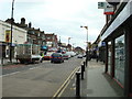
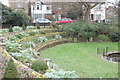
Living in E7 9LH offers a blend of urban convenience and accessible amenities. Retail options include Sainsburys Stratford, Tesco Stratford, and Iceland Forest, while transport hubs like Forest Gate Station and Whipps Cross Bus Interchange provide easy access to London’s broader network. The area’s proximity to Plashet Park and the historic Woodgrange Estate adds green space and architectural interest. The mix of commercial streets, small parks, and transport links creates a dynamic lifestyle, ideal for those who value efficiency without sacrificing proximity to nature or leisure. Residents can enjoy both the bustle of East London and the quiet of preserved historic features, such as the Woodgrange Clock and conservation-area tree-lined roads.
Amenities
Schools
The nearest school to E7 9LH is Gurney School, a special school serving students with specific educational needs. No other schools are listed in the data, meaning families with children requiring mainstream education may need to look further afield. The presence of a special school highlights the area’s focus on supporting specialist educational requirements but does not indicate the availability of primary or secondary schools for general use. Parents should consider additional travel time or the need for nearby private schooling if their child’s needs are not met by Gurney School.
| Rank | School | Type | Entry gender | Ages |
|---|
Explore more schools in this area
Go to Schools tabDemographics
The population of E7 9LH has a median age of 47, with the majority of residents aged 30–64. Home ownership is low at 27%, suggesting a rental-dominated market, and the primary accommodation type is flats. The predominant ethnic group is White, though specific diversity metrics are not detailed. This age profile indicates a community of established professionals and families, with fewer younger residents or retirees. The low home ownership rate may reflect the area’s role as a transitional or commuter zone, where residents prioritise proximity to transport over long-term property investment. The absence of specific deprivation data means quality of life assessments must rely on contextual factors, such as the availability of amenities and safety metrics.
Household Size
Accommodation Type
Tenure
Ethnic Group
Religion
Household Composition
Age
Household Deprivation
NS-SEC
Explore more demographic insights in this area
Go to Demographics tabPlanning
Planning Constraints
- Flood RiskPremium
- Ramsar Wetland SitesPremium
- Area of Outstanding Natural BeautyPremium
- Protected Nature ReservePremium
- Protected WoodlandPremium