Area Overview for E7 8QJ
Photos of E7 8QJ

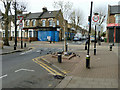
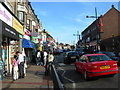
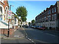
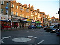
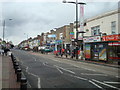
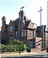

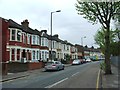
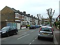
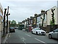
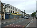
71 photos from this area
Area Information
Key information about the E7 8QJ including its size, population, and administrative classification.
- Area Type
- Postcode
- Area Size
- 6445 m²
- Population
- 2620
- Population Density
- 28791 people/km²
House Prices in E7 8QJ
53
Properties
£234,427
Average Sold Price
£44,500
Lowest Price
£435,000
Highest Price
Showing 53 properties
| Address | Type | Beds | Baths | Last Sale Price | Last Sale Date | |
|---|---|---|---|---|---|---|
| 192 Shrewsbury Road, Forest Gate, London, E7 8QJ | house | - | - | £435,000 | Aug 2025 | |
| 204 Shrewsbury Road, Forest Gate, London, E7 8QJ | house | - | - | £213,132 | Nov 2022 | |
| 170 Shrewsbury Road, Forest Gate, London, E7 8QJ | house | - | - | £435,000 | Jun 2021 | |
| 220 Shrewsbury Road, Forest Gate, London, E7 8QJ | Terraced | 3 | 1 | £425,000 | Apr 2019 | |
| 212 Shrewsbury Road, Forest Gate, London, E7 8QJ | Terraced | 3 | - | £300,000 | May 2014 | |
| 166 Shrewsbury Road, Forest Gate, London, E7 8QJ | house | 4 | 1 | £249,995 | Mar 2012 | |
| 218 Shrewsbury Road, Forest Gate, London, E7 8QJ | house | - | - | £185,000 | Sep 2006 | |
| 174 Shrewsbury Road, Forest Gate, London, E7 8QJ | house | - | - | £220,000 | Jun 2005 | |
| 216 Shrewsbury Road, Forest Gate, London, E7 8QJ | Terraced | 4 | 1 | £175,000 | Aug 2004 | |
| 182 Shrewsbury Road, Forest Gate, London, E7 8QJ | Terraced | - | - | £73,000 | Apr 1999 |
Page 1 of 6
Energy Efficiency in E7 8QJ
Amenities
Schools
| Rank | School | Type | Entry gender | Ages |
|---|
Explore more schools in this area
Go to Schools tabDemographics
Household Size
Family (3-5 people)
most common
Accommodation Type
Houses
most common
Tenure
45
majority
Ethnic Group
asian_total
most common
Religion
N/A
most common
Household Composition
N/A
most common
Age
22
median
Adults (30-64 years)
most common
Household Deprivation
N/A
with no deprivation
NS-SEC
21
in Lower managerial occupations
Explore more demographic insights in this area
Go to Demographics tabPlanning
Planning Constraints
- Flood RiskPremium
- Ramsar Wetland SitesPremium
- Area of Outstanding Natural BeautyPremium
- Protected Nature ReservePremium
- Protected WoodlandPremium