Area Overview for E7 8AL
Photos of E7 8AL

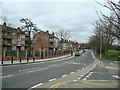
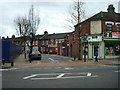


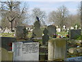

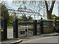
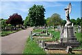
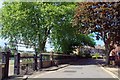
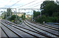
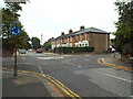
84 photos from this area
Area Information
Key information about the E7 8AL including its size, population, and administrative classification.
- Area Type
- Postcode
- Area Size
- 8654 m²
- Population
- 1833
- Population Density
- 12286 people/km²
House Prices in E7 8AL
59
Properties
£269,900
Average Sold Price
£31,600
Lowest Price
£518,000
Highest Price
Showing 59 properties
| Address | Type | Beds | Baths | Last Sale Price | Last Sale Date | |
|---|---|---|---|---|---|---|
| 40 Shrewsbury Road, Forest Gate, London, E7 8AL | Terraced | 3 | 1 | £518,000 | Dec 2023 | |
| 90 Shrewsbury Road, Forest Gate, London, E7 8AL | house | - | - | £235,000 | Aug 2023 | |
| 44 Shrewsbury Road, Forest Gate, London, E7 8AL | house | - | - | £500,000 | Jan 2023 | |
| 72 Shrewsbury Road, Forest Gate, London, E7 8AL | Terraced | 2 | 1 | £485,000 | Apr 2021 | |
| 62 Shrewsbury Road, Forest Gate, London, E7 8AL | Terraced | 4 | 2 | £470,000 | Apr 2018 | |
| 94 Shrewsbury Road, Forest Gate, London, E7 8AL | house | - | - | £350,000 | Sep 2017 | |
| 78 Shrewsbury Road, Forest Gate, London, E7 8AL | Terraced | 5 | 2 | £390,000 | Jul 2015 | |
| 56 Shrewsbury Road, Forest Gate, London, E7 8AL | house | 3 | - | £332,000 | Aug 2014 | |
| 70 Shrewsbury Road, Forest Gate, London, E7 8AL | house | 4 | - | £305,000 | May 2007 | |
| 68 Shrewsbury Road, Forest Gate, London, E7 8AL | house | - | - | £250,000 | Aug 2006 |
Page 1 of 6
Energy Efficiency in E7 8AL
Amenities
Schools
| Rank | School | Type | Entry gender | Ages |
|---|
Explore more schools in this area
Go to Schools tabDemographics
Household Size
Family (3-5 people)
most common
Accommodation Type
Houses
most common
Tenure
40
majority
Ethnic Group
asian_total
most common
Religion
N/A
most common
Household Composition
N/A
most common
Age
47
median
Adults (30-64 years)
most common
Household Deprivation
N/A
with no deprivation
NS-SEC
19
in Lower managerial occupations
Explore more demographic insights in this area
Go to Demographics tabPlanning
Planning Constraints
- Flood RiskPremium
- Ramsar Wetland SitesPremium
- Area of Outstanding Natural BeautyPremium
- Protected Nature ReservePremium
- Protected WoodlandPremium