Area Overview for E7 0QW
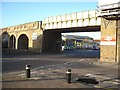
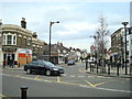
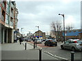
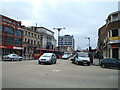
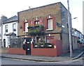
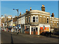
Photos of E7 0QW


Area Information
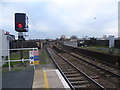
E7 0QW is a small residential postcode area nestled in the Forest Gate South ward of Newham, East London. With a population of 1,969, it is a compact cluster of Victorian terraced houses, brick-built flats, and commercial strips along main roads. The area’s name traces back to a 17th-century gate that once controlled cattle movement from Epping Forest, later demolished in 1881. Development accelerated in the 1850s with estates like Woodgrange, featuring grand villas and tree-lined avenues. Today, it blends historic architecture with modern connectivity. Residents benefit from proximity to Forest Gate Station, London City Airport, and multiple rail, metro, and ferry routes. The area’s character is defined by its mix of residential streets, small parks, and commercial hubs, offering a suburban feel within London’s bustling east. Its location near major transport arteries and amenities makes it appealing for commuters and families seeking a balance of convenience and historical charm.
- Area Type
- Postcode
- Area Size
- Not available
- Population
- 1969
- Population Density
- 14268 people/km²
E7 0QW’s property market is characterised by a high proportion of rental properties, with only 21% of homes owned by residents. The accommodation type is predominantly flats, which aligns with the area’s compact residential layout and historical development as a garden suburb. This suggests a market skewed towards tenants rather than homeowners, likely influenced by the area’s proximity to transport links and commercial hubs. For buyers, the small size of the postcode and its surrounding areas may limit property options, with flats being the primary stock. The low home ownership rate could indicate affordability challenges or a preference for rental living among residents. Prospective buyers should consider the limited availability of owner-occupied properties and the potential for competition in the flat market.
House Prices in E7 0QW
No properties found in this postcode.
Energy Efficiency in E7 0QW
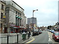
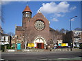
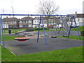
Living in E7 0QW offers a range of amenities within practical reach. Retail options include Iceland Forest, Tesco Forest Gate, and Lidl Woodgrange Road, catering to daily shopping needs. The area’s transport links provide access to parks like Plashet Park and the Woodgrange Clock, offering green spaces for leisure. Residents can also utilise ferry services at East India Pier and North Greenwich Pier, or fly from London City Airport. The mix of retail, transport, and recreational facilities creates a convenient lifestyle, blending urban convenience with small-town charm. The presence of historic sites like the Woodgrange Estate, a Conservation Area with tree-lined roads and grand villas, adds cultural value. This combination of practical amenities and heritage makes E7 0QW appealing for those seeking accessibility without sacrificing character.
Amenities
Schools
The nearest school to E7 0QW is Kay Rowe Nursery School, a nursery providing early education for young children. No primary or secondary schools are listed in the data, meaning families may need to look beyond the immediate area for comprehensive schooling. The presence of a nursery suggests some local provision for young children, but parents seeking full-time education for older children would need to explore nearby wards or commute to larger educational institutions. The absence of detailed school ratings or Ofsted reports means evaluating the quality of local education would require external research. For families prioritising proximity to schools, E7 0QW may not offer the full range of options needed for all stages of a child’s education.
| Rank | School | Type | Entry gender | Ages |
|---|
Explore more schools in this area
Go to Schools tabDemographics
The population of E7 0QW has a median age of 47, with the majority of residents aged 30–64 years. This suggests a community of working-age adults and older professionals. Home ownership is low, at 21%, indicating that most households are renters. The predominant accommodation type is flats, reflecting the area’s density and historical development patterns. The largest ethnic group is the Asian community, though specific proportions are not provided. The age profile and rental market suggest a transient or professional demographic, with families and individuals seeking affordable housing in a well-connected area. The absence of data on deprivation levels means quality of life factors like access to services and housing affordability must be inferred from available infrastructure and amenities.
Household Size
Accommodation Type
Tenure
Ethnic Group
Religion
Household Composition
Age
Household Deprivation
NS-SEC
Explore more demographic insights in this area
Go to Demographics tabPlanning
Planning Constraints
- Flood RiskPremium
- Ramsar Wetland SitesPremium
- Area of Outstanding Natural BeautyPremium
- Protected Nature ReservePremium
- Protected WoodlandPremium