Area Overview for E7 0LY
Photos of E7 0LY


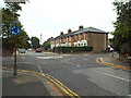
84 photos from this area
Area Information
Key information about the E7 0LY including its size, population, and administrative classification.
- Area Type
- Postcode
- Area Size
- 7570 m²
- Population
- 1955
- Population Density
- 10965 people/km²
House Prices in E7 0LY
33
Properties
£380,972
Average Sold Price
£76,000
Lowest Price
£875,000
Highest Price
Showing 33 properties
| Address | Type | Beds | Baths | Last Sale Price | Last Sale Date | |
|---|---|---|---|---|---|---|
| 69 Tylney Road, Forest Gate, London, E7 0LY | Terraced | 3 | - | £875,000 | Nov 2021 | |
| 82 Tylney Road, Forest Gate, London, E7 0LY | Terraced | 4 | 1 | £820,000 | Mar 2018 | |
| 88 Tylney Road, Forest Gate, London, E7 0LY | house | - | - | £845,000 | Sep 2017 | |
| 72 Tylney Road, Forest Gate, London, E7 0LY | Terraced | 5 | 2 | £690,000 | Dec 2016 | |
| 76 Tylney Road, Forest Gate, London, E7 0LY | Terraced | 3 | 1 | £550,000 | May 2015 | |
| 84 Tylney Road, Forest Gate, London, E7 0LY | Terraced | 3 | - | £435,000 | Jan 2014 | |
| 57 Tylney Road, Forest Gate, London, E7 0LY | house | - | - | £331,000 | Jun 2010 | |
| 55 Tylney Road, Forest Gate, London, E7 0LY | Terraced | - | - | £237,000 | Jul 2009 | |
| 63 Tylney Road, Forest Gate, London, E7 0LY | Terraced | - | - | £300,000 | Mar 2007 | |
| 92 Tylney Road, Forest Gate, London, E7 0LY | Terraced | - | - | £250,000 | Mar 2006 |
Page 1 of 4
Energy Efficiency in E7 0LY
Amenities
Schools
| Rank | School | Type | Entry gender | Ages |
|---|
Explore more schools in this area
Go to Schools tabDemographics
Household Size
Family (3-5 people)
most common
Accommodation Type
Houses
most common
Tenure
55
majority
Ethnic Group
White
most common
Religion
N/A
most common
Household Composition
N/A
most common
Age
47
median
Adults (30-64 years)
most common
Household Deprivation
N/A
with no deprivation
NS-SEC
34
in Lower managerial occupations
Explore more demographic insights in this area
Go to Demographics tabPlanning
Planning Constraints
- Flood RiskPremium
- Ramsar Wetland SitesPremium
- Area of Outstanding Natural BeautyPremium
- Protected Nature ReservePremium
- Protected WoodlandPremium