Area Overview for E7 0LG
Photos of E7 0LG
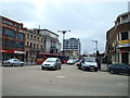
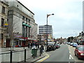
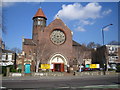
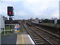
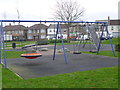
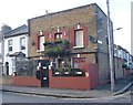
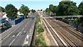
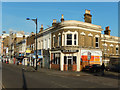
80 photos from this area
Area Information
Key information about the E7 0LG including its size, population, and administrative classification.
- Area Type
- Postcode
- Area Size
- 5450 m²
- Population
- 1955
- Population Density
- 10965 people/km²
House Prices in E7 0LG
36
Properties
£501,317
Average Sold Price
£133,500
Lowest Price
£870,000
Highest Price
Showing 36 properties
| Address | Type | Beds | Baths | Last Sale Price | Last Sale Date | |
|---|---|---|---|---|---|---|
| 54 Godwin Road, Forest Gate, London, E7 0LG | Terraced | 5 | 3 | £870,000 | Dec 2024 | |
| 58A Godwin Road, Forest Gate, London, E7 0LG | Terraced | 2 | 1 | £340,000 | Jun 2024 | |
| 68 Godwin Road, Forest Gate, London, E7 0LG | house | - | - | £742,500 | Jun 2021 | |
| 62 Godwin Road, Forest Gate, London, E7 0LG | Terraced | 4 | 2 | £764,000 | Dec 2020 | |
| Gate House, 72A Godwin Road, Forest Gate, London, E7 0LG | Detached | 3 | 1 | £720,000 | Feb 2018 | |
| 44 Godwin Road, Forest Gate, London, E7 0LG | Terraced | 4 | 2 | £750,000 | Oct 2017 | |
| 60 Godwin Road, Forest Gate, London, E7 0LG | Terraced | 4 | 1 | £685,000 | Jul 2017 | |
| 56 Godwin Road, Forest Gate, London, E7 0LG | Flat | - | - | £233,800 | Jul 2014 | |
| 76 Godwin Road, Forest Gate, London, E7 0LG | house | - | - | £287,000 | Aug 2007 | |
| 80 Godwin Road, Forest Gate, London, E7 0LG | house | - | - | £270,000 | Jun 2004 |
Page 1 of 4
Energy Efficiency in E7 0LG
Amenities
Schools
| Rank | School | Type | Entry gender | Ages |
|---|
Explore more schools in this area
Go to Schools tabDemographics
Household Size
Family (3-5 people)
most common
Accommodation Type
Houses
most common
Tenure
55
majority
Ethnic Group
White
most common
Religion
N/A
most common
Household Composition
N/A
most common
Age
47
median
Adults (30-64 years)
most common
Household Deprivation
N/A
with no deprivation
NS-SEC
34
in Lower managerial occupations
Explore more demographic insights in this area
Go to Demographics tabPlanning
Planning Constraints
- Flood RiskPremium
- Ramsar Wetland SitesPremium
- Area of Outstanding Natural BeautyPremium
- Protected Nature ReservePremium
- Protected WoodlandPremium