Area Overview for E7 0JQ
Photos of E7 0JQ
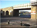
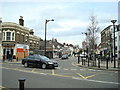
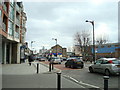

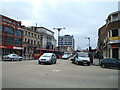
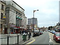

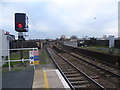
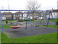
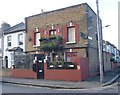


80 photos from this area
Area Information
Key information about the E7 0JQ including its size, population, and administrative classification.
- Area Type
- Postcode
- Area Size
- 5415 m²
- Population
- 2333
- Population Density
- 14088 people/km²
House Prices in E7 0JQ
38
Properties
£307,185
Average Sold Price
£50,000
Lowest Price
£676,000
Highest Price
Showing 38 properties
| Address | Type | Beds | Baths | Last Sale Price | Last Sale Date | |
|---|---|---|---|---|---|---|
| 69 Chestnut Avenue, Forest Gate, London, E7 0JQ | Terraced | 2 | 1 | £605,000 | May 2024 | |
| 13 Chestnut Avenue, Forest Gate, London, E7 0JQ | Terraced | 2 | 2 | £676,000 | Jan 2024 | |
| 11 Chestnut Avenue, Forest Gate, London, E7 0JQ | Terraced | 2 | 1 | £450,000 | Jun 2023 | |
| 43 Chestnut Avenue, Forest Gate, London, E7 0JQ | Terraced | 2 | 1 | £612,000 | Aug 2022 | |
| 21 Chestnut Avenue, Forest Gate, London, E7 0JQ | Terraced | 2 | 1 | £591,000 | Dec 2021 | |
| 35 Chestnut Avenue, Forest Gate, London, E7 0JQ | house | 2 | 1 | £562,500 | Dec 2020 | |
| 33 Chestnut Avenue, Forest Gate, London, E7 0JQ | Terraced | 2 | 1 | £586,000 | Jun 2020 | |
| 71 Chestnut Avenue, Forest Gate, London, E7 0JQ | Terraced | 2 | 1 | £475,000 | Nov 2018 | |
| 53 Chestnut Avenue, Forest Gate, London, E7 0JQ | Terraced | 2 | 1 | £520,000 | Apr 2018 | |
| 73 Chestnut Avenue, Forest Gate, London, E7 0JQ | Terraced | 2 | 1 | £400,000 | Jun 2015 |
Page 1 of 4
Energy Efficiency in E7 0JQ
Amenities
Schools
| Rank | School | Type | Entry gender | Ages |
|---|
Explore more schools in this area
Go to Schools tabDemographics
Household Size
Family (3-5 people)
most common
Accommodation Type
Houses
most common
Tenure
43
majority
Ethnic Group
White
most common
Religion
N/A
most common
Household Composition
N/A
most common
Age
47
median
Adults (30-64 years)
most common
Household Deprivation
N/A
with no deprivation
NS-SEC
32
in Lower managerial occupations
Explore more demographic insights in this area
Go to Demographics tabPlanning
Planning Constraints
- Flood RiskPremium
- Ramsar Wetland SitesPremium
- Area of Outstanding Natural BeautyPremium
- Protected Nature ReservePremium
- Protected WoodlandPremium