Area Overview for E7 0BA
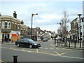
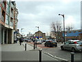
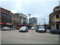
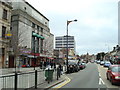
Photos of E7 0BA


Area Information
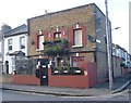
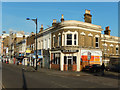
E7 0BA is a small residential cluster in East London, part of the Forest Gate district within Newham. With a population of 1,715, it is a compact area defined by Victorian terraced housing, brick-built properties, and narrow streets lined with small parks and commercial strips. Historically linked to the parish of West Ham, it lies south of Woodford Road, near coordinates 51.54596, 0.01387. Daily life here blends urban convenience with suburban charm, with residents walking to nearby shops, transport hubs, and green spaces. The area’s character stems from its 19th-century development, including the Woodgrange Estate, a Conservation Area with tree-lined roads and historic villas. While modest in size, E7 0BA offers a mix of residential calm and connectivity to London’s broader infrastructure, from rail links to the city’s financial district to proximity to London City Airport. Its compact nature means community ties are tight, with amenities and services within practical reach for most residents.
- Area Type
- Postcode
- Area Size
- Not available
- Population
- 1715
- Population Density
- 11411 people/km²
E7 0BA’s property market is characterised by a low home ownership rate of 29%, indicating that most residents rent rather than own their homes. The accommodation type is predominantly flats, a legacy of the area’s 19th-century development as a residential district with terraced housing. This suggests a market skewed towards rental properties, with limited availability of owner-occupied homes. The compact nature of the postcode means property choices are constrained to the immediate area, with little scope for expansion into surrounding districts. For buyers, this implies competition for the limited number of flats available, though the area’s proximity to transport links and amenities may offset its smaller footprint. The rental market here likely caters to commuters and professionals seeking access to London’s central business districts, with flats offering practical, affordable housing in a connected location.
House Prices in E7 0BA
No properties found in this postcode.
Energy Efficiency in E7 0BA
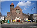
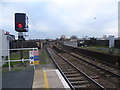
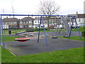
Living in E7 0BA offers access to a range of amenities within practical reach. Retail options include Iceland Forest, Tesco Forest Gate, and Lidl Woodgrange Road, providing everyday shopping needs. Transport hubs like Forest Gate Station and Stratford High Street metro stop ensure easy access to the city. Plashet Park, opened in 1891, offers green space for recreation, while the Woodgrange Estate’s Conservation Area features historic villas and tree-lined streets. The area’s proximity to London City Airport and ferry piers adds to its connectivity. The mix of retail, transport, and green space supports a balanced lifestyle, blending urban convenience with pockets of historical character.
Amenities
Schools
The nearest school to E7 0BA is Quwwat Ul Islam Girls’ School, an independent institution with a good Ofsted rating. As an independent school, it operates separately from the state system, offering a distinct educational approach. The presence of a single named school in the data highlights the limited number of educational options within the immediate vicinity. Families relying on state education may need to look beyond the postcode for broader choices, though the quality of this independent school suggests it could meet specific needs. The absence of other schools in the data means the area’s educational landscape is narrow, potentially requiring longer commutes for students attending state-run institutions.
| Rank | School | Type | Entry gender | Ages |
|---|
Explore more schools in this area
Go to Schools tabDemographics
The population of E7 0BA skews towards adults aged 30–64, with a median age of 47. Home ownership is relatively low at 29%, suggesting a rental-dominated market. The majority of accommodation is in flats, reflecting the area’s historical development as a residential district with terraced housing. The predominant ethnic group is Asian, though specific subgroups are not detailed. This demographic profile indicates a mature, settled community with established family structures. The lower home ownership rate may reflect the area’s role as a rental hub, potentially attracting commuters or those prioritising location over property investment. The age distribution suggests a balance between working-age residents and older adults, with limited data on younger families. The absence of specific deprivation statistics means quality of life assessments rely on contextual factors like transport access and safety.
Household Size
Accommodation Type
Tenure
Ethnic Group
Religion
Household Composition
Age
Household Deprivation
NS-SEC
Explore more demographic insights in this area
Go to Demographics tabPlanning
Planning Constraints
- Flood RiskPremium
- Ramsar Wetland SitesPremium
- Area of Outstanding Natural BeautyPremium
- Protected Nature ReservePremium
- Protected WoodlandPremium