Area Overview for E6 6HX
Photos of E6 6HX
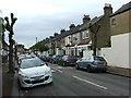
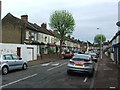
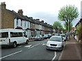
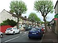
75 photos from this area
Area Information
Key information about the E6 6HX including its size, population, and administrative classification.
- Area Type
- Postcode
- Area Size
- 5329 m²
- Population
- 2031
- Population Density
- 9779 people/km²
House Prices in E6 6HX
22
Properties
£202,000
Average Sold Price
£70,000
Lowest Price
£350,000
Highest Price
Showing 22 properties
| Address | Type | Beds | Baths | Last Sale Price | Last Sale Date | |
|---|---|---|---|---|---|---|
| 6 Bream Gardens, East Ham, London, E6 6HX | Terraced | 3 | 1 | £350,000 | Apr 2023 | |
| 4 Bream Gardens, East Ham, London, E6 6HX | Flat | 3 | 1 | £280,000 | Feb 2022 | |
| 15 Bream Gardens, East Ham, London, E6 6HX | Flat | 3 | 1 | £331,500 | Feb 2019 | |
| 2 Bream Gardens, East Ham, London, E6 6HX | Flat | 3 | - | £270,000 | Oct 2016 | |
| 8 Bream Gardens, East Ham, London, E6 6HX | house | - | - | £220,000 | Oct 2013 | |
| 19 Bream Gardens, East Ham, London, E6 6HX | Flat | - | - | £179,000 | Sep 2010 | |
| 16 Bream Gardens, East Ham, London, E6 6HX | Flat | 3 | 1 | £173,000 | Oct 2006 | |
| 20 Bream Gardens, East Ham, London, E6 6HX | Flat | - | - | £168,000 | Jul 2006 | |
| 1 Bream Gardens, East Ham, London, E6 6HX | Flat | 3 | 1 | £164,000 | Jul 2005 | |
| 3 Bream Gardens, East Ham, London, E6 6HX | Flat | - | - | £90,000 | Mar 2002 |
Page 1 of 3
Energy Efficiency in E6 6HX
Amenities
Schools
| Rank | School | Type | Entry gender | Ages |
|---|
Explore more schools in this area
Go to Schools tabDemographics
Household Size
Family (3-5 people)
most common
Accommodation Type
Houses
most common
Tenure
34
majority
Ethnic Group
asian_total
most common
Religion
N/A
most common
Household Composition
N/A
most common
Age
47
median
Adults (30-64 years)
most common
Household Deprivation
N/A
with no deprivation
NS-SEC
19
in Lower managerial occupations
Explore more demographic insights in this area
Go to Demographics tabPlanning
Planning Constraints
- Flood RiskPremium
- Ramsar Wetland SitesPremium
- Area of Outstanding Natural BeautyPremium
- Protected Nature ReservePremium
- Protected WoodlandPremium