Area Overview for E6 5WZ
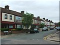
Photos of E6 5WZ


Area Information
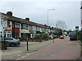
E6 5WZ is a small, tightly knit residential cluster in east London, home to 2120 people. Its compact size means it feels intimate, with a focus on local living rather than sprawling development. The area’s character is shaped by its proximity to major transport routes and retail hubs, making it a practical choice for commuters and families alike. With a median age of 47, the community is largely composed of adults aged 30–64, suggesting a balance of established residents and those in their prime working years. The postcode’s location near key infrastructure, such as rail lines and ferry services, ensures easy access to London’s broader network. Daily life here revolves around nearby amenities, from supermarkets like Tesco East Ham to transport nodes like Beckton Station. While the area lacks large green spaces, its connectivity to the city’s economic and cultural centres compensates, offering a blend of convenience and accessibility. For those seeking a quiet yet functional postcode with strong transport links, E6 5WZ presents a compelling case.
- Area Type
- Postcode
- Area Size
- Not available
- Population
- Not available
- Population Density
- Not available
The property market in E6 5WZ is characterised by a 44% home ownership rate, with houses forming the predominant accommodation type. This suggests a market skewed towards owner-occupied properties, though the relatively low ownership figure indicates a significant rental sector. The small area size means the housing stock is limited, which could make competition for properties fierce. For buyers, this implies that available homes may be in high demand, particularly for those seeking the space and structure that houses offer. The lack of flats or apartments may appeal to families or professionals requiring larger living areas. However, the limited size of the postcode means that buyers should consider nearby areas for more options. The market’s balance between owner-occupied and rental properties could influence both pricing and availability, depending on local economic trends.
House Prices in E6 5WZ
No properties found in this postcode.
Energy Efficiency in E6 5WZ
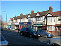
Living in E6 5WZ offers access to a range of amenities within practical reach. The area is served by major supermarkets such as Tesco East Ham, Spar Eastham, and Sainsburys Beckton, ensuring everyday shopping needs are met. Transport hubs like Beckton Station, East Ham Station, and Beckton Park provide easy access to rail and metro services, while ferry piers at Woolwich Arsenal and Barrier Gardens connect to Thames-side destinations. London City Airport is a short journey away, adding to the area’s appeal for those working in aviation or finance. The presence of multiple stations and ferry services also facilitates leisure travel. While the area lacks large parks, its proximity to transport and retail makes it a convenient base for those prioritising accessibility over expansive green spaces. The combination of retail, transport, and connectivity creates a lifestyle focused on efficiency and practicality.
Amenities
Schools
| Rank | School | Type | Entry gender | Ages |
|---|
Explore more schools in this area
Go to Schools tabDemographics
The population of E6 5WZ is predominantly adults aged 30–64, with a median age of 47. This suggests a mature, stable community with a focus on long-term residency. Home ownership stands at 44%, indicating a mix of owner-occupied properties and rental units. The area’s accommodation is largely houses, which may appeal to those seeking more space than flats. The predominant ethnic group is Asian, reflecting a culturally diverse demographic. This diversity shapes the social fabric, though specific data on community cohesion or cultural events is not provided. The relatively low home ownership rate could imply a higher proportion of renters, potentially affecting property market dynamics. For buyers, understanding the age profile and ownership structure is key to assessing demand and long-term value. The area’s demographic profile suggests a community that values stability and proximity to essential services.
Household Size
Accommodation Type
Tenure
Ethnic Group
Religion
Household Composition
Age
Household Deprivation
NS-SEC
Explore more demographic insights in this area
Go to Demographics tabPlanning
Planning Constraints
- Flood RiskPremium
- Ramsar Wetland SitesPremium
- Area of Outstanding Natural BeautyPremium
- Protected Nature ReservePremium
- Protected WoodlandPremium
- Crime RiskPremium