Area Overview for E6 4GP
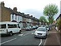
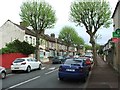
Photos of E6 4GP


Area Information
Living in E6 4GP means being part of a small, tightly knit residential cluster in east London. With a population of 1,555 and a density of 655 people per square kilometre, the area is compact yet functional. The community here is predominantly adults aged 30–64, reflecting a mature demographic. This postcode sits near key transport hubs and amenities, making it practical for commuters and families. While the housing stock is limited to flats, the area’s proximity to London City Airport, rail networks, and ferry services ensures connectivity to broader London. Daily life here balances urban convenience with the relative quiet of a smaller postcode. Residents benefit from nearby primary schools, retail outlets, and green spaces, though the high crime risk noted in assessments requires attention. E6 4GP is not for those seeking sprawling estates but suits those prioritising accessibility over space. Its character lies in its strategic position, blending residential simplicity with the vibrancy of surrounding infrastructure.
- Area Type
- Postcode
- Area Size
- Not available
- Population
- 1555
- Population Density
- 655 people/km²
E6 4GP’s property market is characterised by a 30% home ownership rate, indicating that the majority of residents are renters. The housing stock is almost entirely flats, a common feature in smaller, densely populated postcode areas. This suggests limited scope for owner-occupied properties, with the market likely dominated by rental units. The small size of the area means the housing stock is constrained, which could impact availability for buyers seeking larger homes. Flats in E6 4GP may appeal to those prioritising proximity to transport links and urban amenities over private space. However, the low home ownership rate and limited housing diversity mean buyers should consider the area as part of a broader search, rather than a standalone destination. The market here is practical but not expansive, reflecting the postcode’s role as a functional, rather than aspirational, residential zone.
House Prices in E6 4GP
No properties found in this postcode.
Energy Efficiency in E6 4GP
Life in E6 4GP is shaped by its proximity to essential amenities. Retail options include Sainsburys Beckton, Lidl Claps, and Iceland Beckton, offering everyday shopping convenience. Transport links are extensive, with rail stations like Barking and Woolwich Dockyard, plus ferry services such as the Woolwich Ferry, providing easy access to London’s broader network. London City Airport is nearby, ideal for frequent travellers. Parks and open spaces are less explicitly detailed, but the area’s small size suggests limited greenery. The presence of Beckton Station and nearby leisure spots like Beckton Park indicates a balance between urban living and recreational opportunities. The mix of retail, transport, and travel hubs means daily life here is efficient, though the area’s compact nature may require residents to venture slightly further for more diverse leisure options.
Amenities
Schools
The nearest school to E6 4GP is North Beckton Primary School, which serves the local community. This is a primary school with an Ofsted rating of ‘good’, indicating it meets standards for teaching quality and student outcomes. The absence of secondary schools in the immediate vicinity means families may need to consider nearby areas for secondary education. However, the primary school’s rating suggests a reliable foundation for younger children. The single school listed reflects the area’s small size, which may limit educational options. For families, this means careful planning for secondary schooling, though the primary school’s performance offers a positive starting point. The school’s presence also contributes to the area’s community feel, acting as a focal point for local activity.
| Rank | School | Type | Entry gender | Ages |
|---|
Explore more schools in this area
Go to Schools tabDemographics
The population of E6 4GP is 1,555, with a median age of 47. The majority of residents fall within the 30–64 age range, indicating a mature, established community. Home ownership is low at 30%, suggesting most residents are renters, likely drawn by the area’s practicality rather than long-term investment. The accommodation is predominantly flats, reflecting the limited housing stock typical of smaller postcode areas. The predominant ethnic group is White, though no specific data on diversity or deprivation is provided. This demographic profile suggests a community focused on stability and convenience. The age range implies a mix of professionals and families, though the absence of data on household composition means assumptions cannot be made. The low home ownership rate may indicate affordability challenges or a transient population. Overall, E6 4GP caters to those prioritising proximity to transport and services over property equity.
Household Size
Accommodation Type
Tenure
Ethnic Group
Religion
Household Composition
Age
Household Deprivation
NS-SEC
Explore more demographic insights in this area
Go to Demographics tabPlanning
Planning Constraints
- Flood RiskPremium
- Ramsar Wetland SitesPremium
- Area of Outstanding Natural BeautyPremium
- Protected Nature ReservePremium
- Protected WoodlandPremium