Area Overview for E6 4EP
Photos of E6 4EP


Area Information
Living in E6 4EP means being part of a compact residential cluster in east London, home to 1,880 residents. This small area is defined by its proximity to transport hubs and a mix of local amenities. The community here is predominantly adults aged 30–64, reflecting a mature demographic with established roots. Daily life is shaped by easy access to metro, rail, and ferry services, which connect residents to nearby towns and the city centre. The area’s modest size means a tight-knit feel, though it remains integrated with broader London infrastructure. With no significant natural or planning constraints, the area is practical for those prioritising connectivity over scenic landscapes. The presence of a sixth-form college nearby suggests a focus on education, though primary schools are not listed. E6 4EP is not a high-end suburb but a functional residential zone, ideal for commuters or those seeking a base near transport links. Its low flood risk and absence of protected sites make it straightforward for development, though the medium crime risk score means residents should remain vigilant.
- Area Type
- Postcode
- Area Size
- Not available
- Population
- 1880
- Population Density
- 17554 people/km²
The property market in E6 4EP is characterised by a 51% home ownership rate, with houses being the predominant accommodation type. This contrasts with many inner London areas, where flats are more common, indicating a focus on family homes or larger properties. The relatively low home ownership percentage suggests a significant rental market, which may appeal to buyers seeking investment opportunities. However, the area’s small size means the housing stock is limited, and buyers should consider proximity to transport as a key factor. The absence of luxury or high-end properties implies that E6 4EP is not a premium market, but its affordability and practicality may attract first-time buyers or those prioritising location over aesthetics. The lack of protected sites or planning constraints makes it easier to develop or renovate properties, though the medium crime risk score could influence perceptions of safety. For buyers, the challenge lies in balancing the area’s functional appeal with its modest scale.
House Prices in E6 4EP
No properties found in this postcode.
Energy Efficiency in E6 4EP
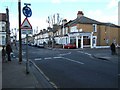
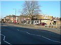
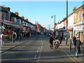
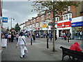
Life in E6 4EP is shaped by its proximity to retail, transport, and leisure options. The area has five notable retail outlets, including Lidl, Sainsburys, and Tesco, providing everyday shopping convenience. For dining, while specific restaurants are not listed, the presence of major supermarkets suggests a range of food options. Transport links are a key feature, with metro, rail, and ferry services enabling quick access to nearby towns and the city. The Woolwich Ferry offers scenic river crossings, adding to the area’s practicality. The absence of parks or recreational spaces is notable, though nearby areas may offer green spaces. The area’s character is defined by its functionality, with amenities focused on connectivity rather than leisure. Residents can rely on nearby transport hubs for both daily commutes and weekend excursions, though the lack of dedicated leisure facilities may require travel to larger centres. The lifestyle here is practical, prioritising accessibility over luxury.
Amenities
Schools
The nearest educational institution to E6 4EP is Newham College of Further Education, a sixth-form college catering to older students. No primary or secondary schools are listed in the data, which may be a concern for families requiring early education. The absence of schools in the immediate vicinity suggests that residents must travel to nearby areas for primary or secondary schooling. This could impact the area’s appeal for families with young children, though the presence of a sixth-form college may benefit those seeking higher education or vocational training. The lack of school data beyond the sixth-form college means it is unclear whether the area’s educational offerings are comprehensive. For prospective buyers, proximity to schools outside E6 4EP will be a critical consideration, as transport links to nearby districts will determine the practicality of schooling options.
| Rank | School | Type | Entry gender | Ages |
|---|
Explore more schools in this area
Go to Schools tabDemographics
E6 4EP’s population is skewed towards adults aged 30–64, with a median age of 47. This suggests a community of long-term residents, many of whom may be in their prime working years or nearing retirement. Home ownership rates stand at 51%, slightly below the national average, indicating a mix of owner-occupied and rented properties. The predominant ethnic group is Asian, reflecting broader trends in east London. The area’s housing stock consists mainly of houses, which is unusual for inner London, where flats dominate. This suggests a more family-oriented demographic, though the lack of specific data on household types limits deeper analysis. The absence of deprivation metrics in the data means quality of life cannot be fully assessed, but the presence of multiple retail and transport options implies a reasonable standard of living. The community’s age profile and home ownership figures suggest stability, though the area’s small size means it lacks the diversity of larger suburbs.
Household Size
Accommodation Type
Tenure
Ethnic Group
Religion
Household Composition
Age
Household Deprivation
NS-SEC
Explore more demographic insights in this area
Go to Demographics tabPlanning
Planning Constraints
- Flood RiskPremium
- Ramsar Wetland SitesPremium
- Area of Outstanding Natural BeautyPremium
- Protected Nature ReservePremium
- Protected WoodlandPremium