Area Overview for E6 3PX
Photos of E6 3PX
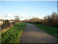


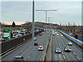
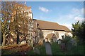
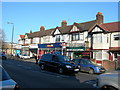
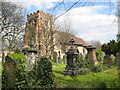
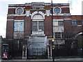
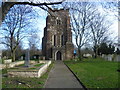
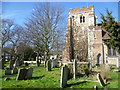
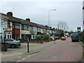
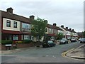
67 photos from this area
Area Information
Key information about the E6 3PX including its size, population, and administrative classification.
- Area Type
- Postcode
- Area Size
- 2.2 hectares
- Population
- Not available
- Population Density
- Not available
House Prices in E6 3PX
32
Properties
£240,958
Average Sold Price
£44,000
Lowest Price
£460,000
Highest Price
Showing 32 properties
| Address | Type | Beds | Baths | Last Sale Price | Last Sale Date | |
|---|---|---|---|---|---|---|
| 156 Sandford Road, East Ham, London, E6 3PX | house | - | - | £425,000 | Aug 2025 | |
| 188 Sandford Road, East Ham, London, E6 3PX | Terraced | 3 | 1 | £420,000 | Dec 2024 | |
| 178 Sandford Road, East Ham, London, E6 3PX | Terraced | 3 | 3 | £460,000 | Oct 2023 | |
| 162 Sandford Road, East Ham, London, E6 3PX | house | - | - | £410,000 | Oct 2021 | |
| 160 Sandford Road, East Ham, London, E6 3PX | Terraced | 3 | 2 | £440,000 | Apr 2021 | |
| 168 Sandford Road, East Ham, London, E6 3PX | Terraced | 3 | 1 | £385,000 | Apr 2018 | |
| 150 Sandford Road, East Ham, London, E6 3PX | house | 3 | 1 | £325,000 | Apr 2018 | |
| 154 Sandford Road, East Ham, London, E6 3PX | Terraced | 3 | - | £240,000 | Sep 2013 | |
| 190 Sandford Road, East Ham, London, E6 3PX | house | - | - | £245,000 | Apr 2013 | |
| 134 Sandford Road, East Ham, London, E6 3PX | Terraced | 4 | 2 | £234,950 | Oct 2012 |
Page 1 of 4
Energy Efficiency in E6 3PX
Amenities
Schools
| Rank | School | Type | Entry gender | Ages |
|---|
Explore more schools in this area
Go to Schools tabDemographics
Household Size
Family (3-5 people)
most common
Accommodation Type
Flats
most common
Tenure
33
majority
Ethnic Group
asian_total
most common
Religion
N/A
most common
Household Composition
N/A
most common
Age
47
median
Adults (30-64 years)
most common
Household Deprivation
N/A
with no deprivation
NS-SEC
17
in Lower managerial occupations
Explore more demographic insights in this area
Go to Demographics tabPlanning
Planning Constraints
- Flood RiskPremium
- Ramsar Wetland SitesPremium
- Area of Outstanding Natural BeautyPremium
- Protected Nature ReservePremium
- Protected WoodlandPremium