Area Overview for E6 2LU
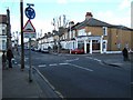
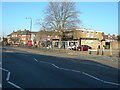
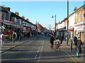
Photos of E6 2LU


Area Information
E6 2LU is a small residential postcode in east London with a population of 2464, reflecting a tight-knit community. The area’s character is shaped by its mix of housing and proximity to transport hubs, making it accessible for commuters. Residents here are predominantly adults aged 30–64, with a median age of 47, suggesting a stable, established population. The postcode’s compact size means daily life is centred around local amenities, with shops, schools, and transport links within easy reach. While the area lacks large-scale attractions, its practicality and connectivity to London’s infrastructure make it appealing for those prioritising convenience over sprawling landscapes. The presence of multiple schools and transport options, combined with a relatively low flood risk, positions E6 2LU as a pragmatic choice for families and professionals seeking a balanced lifestyle. However, the medium crime risk score of 52/100 means residents should remain mindful of standard security measures.
- Area Type
- Postcode
- Area Size
- Not available
- Population
- 2464
- Population Density
- 11990 people/km²
The property market in E6 2LU is characterised by a 34% home ownership rate, suggesting that most properties are rented rather than owner-occupied. The accommodation type is predominantly houses, which is less common in high-density urban areas. This mix of housing stock may appeal to families seeking more space than typical flats, though the small postcode size means the market is limited in scope. Buyers should consider that the area’s property stock is relatively constrained, with limited scope for expansion due to its compact nature. The predominance of houses may also influence local infrastructure, such as school capacity and transport demand. For those seeking investment, the rental market could be viable, but the lack of data on property prices or trends means potential buyers should conduct further local research. The small size of E6 2LU also means that nearby areas may offer more options for those looking to expand their search.
House Prices in E6 2LU
No properties found in this postcode.
Energy Efficiency in E6 2LU
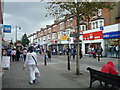
Daily life in E6 2LU is shaped by its accessible amenities, including retail options like Lidl, Sainsburys, and Tesco East Ham, which cater to household needs. The area’s transport network, with stations such as East Ham and Barking, facilitates easy travel to employment hubs or leisure destinations. For recreation, the nearby Woolwich Ferry piers offer waterfront access, though no parks or green spaces are explicitly mentioned in the data. The presence of multiple bus routes, including the Whipps Cross Bus Interchange, adds to the area’s connectivity. While the data does not detail dining or cultural venues, the proximity to major transport links suggests a range of off-site options. The combination of shops, transport, and ferry access creates a practical lifestyle, though residents may need to venture further for more specialised amenities.
Amenities
Schools
Residents of E6 2LU have access to St Michael’s Catholic Primary School, a primary school serving the local community. A second primary school of the same name is also listed, though it may refer to a branch or nearby campus. For secondary and post-16 education, the Newham Collegiate Sixth Form Centre, City of London Academy is available, offering specialist sixth-form provision. The presence of two primary schools and a sixth-form college indicates a range of educational options for families, though no Ofsted ratings are provided. The mix of school types may cater to both younger children and those nearing higher education, but the absence of secondary schools in the immediate area could require commuting for students beyond primary level. Parents should verify the exact locations and capacities of these institutions to ensure they meet their children’s needs.
| Rank | School | Type | Entry gender | Ages |
|---|
Explore more schools in this area
Go to Schools tabDemographics
The population of E6 2LU is predominantly adults aged 30–64, with a median age of 47. This suggests a mature community with a focus on stability and long-term residency. Home ownership in the area stands at 34%, indicating that a majority of households are likely renters. The accommodation type is primarily houses, which contrasts with areas dominated by flats or apartments. The predominant ethnic group is the Asian community, reflecting cultural diversity. While no specific deprivation data is provided, the demographic profile suggests a population that may prioritise family-oriented living. The age range implies a mix of working professionals and older residents, potentially influencing local services and amenities. The relatively low proportion of owner-occupied homes may indicate a rental market dynamic, though the exact balance between renters and buyers is not specified.
Household Size
Accommodation Type
Tenure
Ethnic Group
Religion
Household Composition
Age
Household Deprivation
NS-SEC
Explore more demographic insights in this area
Go to Demographics tabPlanning
Planning Constraints
- Flood RiskPremium
- Ramsar Wetland SitesPremium
- Area of Outstanding Natural BeautyPremium
- Protected Nature ReservePremium
- Protected WoodlandPremium