Area Overview for E6 2LN
Photos of E6 2LN
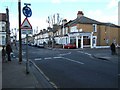
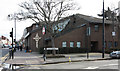
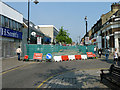
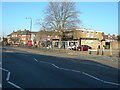
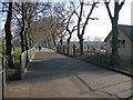


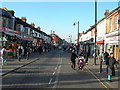
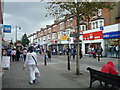
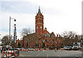
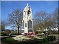
90 photos from this area
Area Information
Key information about the E6 2LN including its size, population, and administrative classification.
- Area Type
- Postcode
- Area Size
- 7592 m²
- Population
- 1821
- Population Density
- 7537 people/km²
House Prices in E6 2LN
52
Properties
£328,568
Average Sold Price
£60,000
Lowest Price
£1,500,000
Highest Price
Showing 52 properties
| Address | Type | Beds | Baths | Last Sale Price | Last Sale Date | |
|---|---|---|---|---|---|---|
| 513 Barking Road, East Ham, London, E6 2LN | Terraced | 3 | 2 | £300,000 | Jan 2023 | |
| 499 Barking Road, East Ham, London, E6 2LN | house | - | - | £330,000 | Jan 2023 | |
| 479 Barking Road, East Ham, London, E6 2LN | Flat | 2 | 1 | £510,000 | Nov 2021 | |
| 529A Barking Road, East Ham, London, E6 2LN | Flat | 1 | - | £210,000 | Sep 2018 | |
| 473 Barking Road, East Ham, London, E6 2LN | undefined | - | - | £1,500,000 | Sep 2018 | |
| 485 Barking Road, East Ham, London, E6 2LN | Terraced | 4 | 2 | £360,000 | Nov 2015 | |
| 491 Barking Road, East Ham, London, E6 2LN | Terraced | 3 | - | £250,000 | Mar 2011 | |
| 509 Barking Road, East Ham, London, E6 2LN | Terraced | 4 | 2 | £249,950 | May 2007 | |
| 511 Barking Road, East Ham, London, E6 2LN | house | - | - | £215,000 | Oct 2006 | |
| 525 Barking Road, East Ham, London, E6 2LN | Terraced | 2 | 1 | £225,000 | Oct 2005 |
Page 1 of 6
Energy Efficiency in E6 2LN
Amenities
Schools
| Rank | School | Type | Entry gender | Ages |
|---|
Explore more schools in this area
Go to Schools tabDemographics
Household Size
Family (3-5 people)
most common
Accommodation Type
Flats
most common
Tenure
29
majority
Ethnic Group
asian_total
most common
Religion
N/A
most common
Household Composition
N/A
most common
Age
47
median
Adults (30-64 years)
most common
Household Deprivation
N/A
with no deprivation
NS-SEC
17
in Lower managerial occupations
Explore more demographic insights in this area
Go to Demographics tabPlanning
Planning Constraints
- Flood RiskPremium
- Ramsar Wetland SitesPremium
- Area of Outstanding Natural BeautyPremium
- Protected Nature ReservePremium
- Protected WoodlandPremium