Area Overview for E6 2DW
Photos of E6 2DW
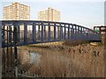
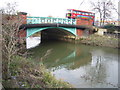
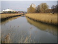
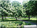
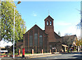
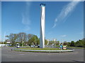
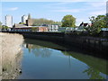
93 photos from this area
Area Information
Key information about the E6 2DW including its size, population, and administrative classification.
- Area Type
- Postcode
- Area Size
- 4796 m²
- Population
- 1691
- Population Density
- 18202 people/km²
House Prices in E6 2DW
22
Properties
£304,516
Average Sold Price
£59,995
Lowest Price
£600,000
Highest Price
Showing 22 properties
| Address | Type | Beds | Baths | Last Sale Price | Last Sale Date | |
|---|---|---|---|---|---|---|
| 195 Clements Road, East Ham, London, E6 2DW | house | - | - | £450,000 | Mar 2025 | |
| 187 Clements Road, East Ham, London, E6 2DW | house | - | - | £450,000 | Mar 2025 | |
| 169 Clements Road, East Ham, London, E6 2DW | Terraced | 4 | 3 | £600,000 | Jan 2025 | |
| 171 Clements Road, East Ham, London, E6 2DW | Terraced | 3 | 2 | £480,000 | Jan 2025 | |
| 203 Clements Road, East Ham, London, E6 2DW | house | - | - | £416,000 | Jun 2022 | |
| 191 Clements Road, East Ham, London, E6 2DW | Terraced | 3 | - | £363,750 | Nov 2021 | |
| 165 Clements Road, East Ham, London, E6 2DW | Terraced | 3 | 1 | £485,000 | Apr 2021 | |
| 193 Clements Road, East Ham, London, E6 2DW | house | - | - | £420,000 | Sep 2018 | |
| 175 Clements Road, East Ham, London, E6 2DW | house | - | - | £235,000 | Feb 2011 | |
| 183 Clements Road, East Ham, London, E6 2DW | house | 3 | 1 | £192,500 | Aug 2009 |
Page 1 of 3
Energy Efficiency in E6 2DW
Amenities
Schools
| Rank | School | Type | Entry gender | Ages |
|---|
Explore more schools in this area
Go to Schools tabDemographics
Household Size
Family (3-5 people)
most common
Accommodation Type
Houses
most common
Tenure
48
majority
Ethnic Group
asian_total
most common
Religion
N/A
most common
Household Composition
N/A
most common
Age
47
median
Adults (30-64 years)
most common
Household Deprivation
N/A
with no deprivation
NS-SEC
18
in Lower managerial occupations
Explore more demographic insights in this area
Go to Demographics tabPlanning
Planning Constraints
- Flood RiskPremium
- Ramsar Wetland SitesPremium
- Area of Outstanding Natural BeautyPremium
- Protected Nature ReservePremium
- Protected WoodlandPremium