Area Overview for E6 1JS
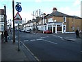
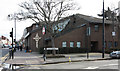
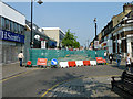
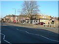
Photos of E6 1JS


Area Information
Living in E6 1JS means residing within a compact residential cluster that covers 7313 square metres. This tiny postcode holds a population of 1983 people, creating an environment with a high population density of 271,148 per square kilometre. The area is distinctly East London, situated near major transport hubs and retail centres in the boroughs of Newham and Coventry. Space is at a premium here, as the small footprint supports nearly 2000 residents in close proximity. Despite the narrow land area, the location offers practical advantages through its proximity to stations at East Ham, Upton Park, and Plaistow. You will find yourself in a postcode that acts as a bridge between residential streets and the wider London network. The sheer concentration of people in such a small space defines the rhythm of daily life. There is no room for suburban sprawl; instead, you live in a tightly knit pocket of urban London. This density delivers convenience but also means you share your immediate surroundings with many neighbours. For a buyer, this translates to a location where everything is within walking distance, yet the estate feels intimate because of its small physical footprint.
- Area Type
- Postcode
- Area Size
- 7313 m²
- Population
- 1983
- Population Density
- 15219 people/km²
The property market in E6 1JS is defined by a housing stock consisting primarily of houses. This stands in contrast to neighbouring areas where high-density flats are more common. Only 31% of residents are homeowners, which indicates that the majority of the housing stock is let to tenants. This high rental share creates a market where houses change hands and move between owners more often than in stable, owner-occupied districts. For a buyer considering homes in E6 1JS, this suggests a competitive environment where properties may stay on the market for shorter periods. The small area size of 7313 square metres restricts the total number of large plots available for purchase. You will be looking at a mix of properties currently occupied by tenants or retired couples. The low ownership rate of roughly three people out of ten means you are entering a market with high liquidity. Potential buyers must weigh the availability of specific house types against the churn of the rental sector. This postcode offers an entry point into suburban-style living in the heart of East London, but the market moves faster than in older, heavily commuter-belt areas.
House Prices in E6 1JS
Showing 75 properties
| Address | Type | Beds | Baths | Last Sale Price | Last Sale Date | |
|---|---|---|---|---|---|---|
| 48 Harrow Road, East Ham, London, E6 1JS | house | - | - | £480,000 | Apr 2022 | |
| 31 Harrow Road, East Ham, London, E6 1JS | house | - | - | £300,000 | Feb 2021 | |
| 13 Harrow Road, East Ham, London, E6 1JS | Terraced | 2 | 1 | £400,000 | Nov 2020 | |
| 11 Harrow Road, East Ham, London, E6 1JS | house | 1 | 2 | £380,000 | Jul 2019 | |
| 42 Harrow Road, East Ham, London, E6 1JS | Terraced | - | - | £335,000 | May 2018 | |
| 23 Harrow Road, East Ham, London, E6 1JS | house | - | - | £379,000 | Jun 2017 | |
| 29 Harrow Road, East Ham, London, E6 1JS | Terraced | 4 | 1 | £197,500 | Aug 2013 | |
| 44 Harrow Road, East Ham, London, E6 1JS | Terraced | - | - | £218,000 | Aug 2007 | |
| 22 Harrow Road, East Ham, London, E6 1JS | Terraced | 4 | 1 | £235,000 | Jan 2007 | |
| 38 Harrow Road, East Ham, London, E6 1JS | house | - | - | £195,000 | Nov 2004 |
Energy Efficiency in E6 1JS
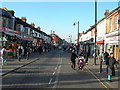
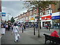
Your daily life in E6 1JS is anchored by a variety of shops and transport hubs within practical reach. There are five major retail outlets including Lidl East, Tesco East Ham, and Sainsburys East, ensuring you can shop for groceries without travel. Five metro stations serve the area, providing quick transfers to the rest of London. You also have access to five rail stations, giving you multiple choices for your morning commute. For leisure, five ferry piers are nearby, including Woolwich Ferry North Pier and Royal Wharf Pier, offering river crossings if you prefer those routes. London City Airport is just one access point away, convenient for short business trips. Although only one bus interchange, Whipps Cross, is listed, the rail network compensates for this. You do not need to drive to access your daily supplies or leisure activities. The combination of supermarkets and rapid transit means you maintain a self-contained routine. Living here ensures you have all essential services at your fingertips while retaining access to the wider city through efficient public transport.
Amenities
Schools
Families living in E6 1JS benefit from direct access to Lathom Junior School, situated nearby. This institution is a primary school with an Ofsted rating of Good. The presence of a single named school in the immediate vicinity suggests a reliance on this specific provision for younger children. You will find that high schools in East London are accessed via secondary transport links rather than being located within this tight cluster. The rating of Good for Lathom Junior School provides a solid educational foundation for children living in the postcode. Parents in this area will need to look beyond this campus for secondary education, as Lathom Junior covers only the primary phase. The proximity to East Ham and Woodgrange Park stations means there are several other educational institutions in the wider vicinity that you could explore. The local education environment is practical, with a known option of good quality primary education right on your doorstep. This stability in school performance is a key factor for families considering homes in this specific cluster.
| Rank | School | Type | Entry gender | Ages |
|---|
Explore more schools in this area
Go to Schools tabDemographics
The community in E6 1JS reflects the broader trends of East London, with a median age of 47 years. Adults between 30 and 64 years constitute the most common age range, indicating a population leaning towards mature families and established professionals. Only 31% of residents own their homes, meaning the majority live in rental accommodation. Houses form the predominant accommodation type in this specific postcode, which is notable for a location where other areas might feature more flats or terraced housing. The population is ethnically diverse, with Asian groups representing the largest demographic. This mix creates a neighbourhood where cultural influences shape the local shops and community spirit. You are likely to interact with residents who have settled in the area for a significant period, given the mature age profile. The low ownership rate suggests a dynamic market where properties move frequently or command high rental demand. Living here means engaging with a community that is neither dominated by families with young children nor by retirees alone. The adult-heavy demographic implies a area where quiet evenings and school runs coexist with working adult schedules.
Household Size
Accommodation Type
Tenure
Ethnic Group
Religion
Household Composition
Age
Household Deprivation
NS-SEC
Explore more demographic insights in this area
Go to Demographics tabPlanning
Planning Constraints
- Flood RiskPremium
- Ramsar Wetland SitesPremium
- Area of Outstanding Natural BeautyPremium
- Protected Nature ReservePremium
- Protected WoodlandPremium