Area Overview for E5 9DD
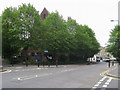
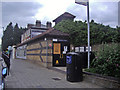
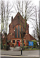
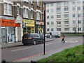
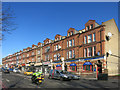
Photos of E5 9DD


Area Information
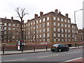
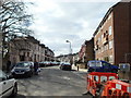
Living in E5 9DD means inhabiting a tightly packed residential cluster in north-east London. The area covers 790 square metres and is home to 2,329 people, creating a high population density of nearly 2.95 million per square kilometre. This compact postcode reflects a mature community, with residents predominantly aged 30–64 and a median age of 47. The area’s small size means proximity to amenities is key, with nearby shops, transport hubs, and schools within practical reach. While the housing stock is largely flats, the community feels distinct due to its concentrated layout and established character. Residents here are likely to value convenience over space, with daily life shaped by the need to navigate a densely populated environment. The area’s proximity to multiple transport routes, including rail, metro, and ferry services, underscores its role as a commuter hub. Despite its density, E5 9DD offers a mix of practicality and accessibility, though its small footprint means choices for housing and lifestyle are limited to what is immediately available.
- Area Type
- Postcode
- Area Size
- 790 m²
- Population
- 2329
- Population Density
- 22160 people/km²
The property market in E5 9DD is characterised by a high proportion of rental properties, with only 19% of homes owned by residents. This suggests the area functions more as a rental market than an owner-occupied one, which may influence the types of properties available. Flats dominate the housing stock, reflecting the area’s compact size and high density. For buyers, this means limited scope for purchasing property, as the market is saturated with rented units. The small footprint of E5 9DD also means that any available homes are likely to be in close proximity to one another, with little variation in housing styles or sizes. Prospective buyers should consider the challenges of competing in a rental-heavy market and the potential for limited long-term investment opportunities. The lack of larger homes or detached properties further restricts options for those seeking more space or different property types.
House Prices in E5 9DD
No properties found in this postcode.
Energy Efficiency in E5 9DD
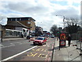
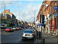
Residents of E5 9DD have access to a range of nearby amenities, including five retail outlets such as Tesco Hackney and Co-op Hackney, which cater to daily shopping needs. The area’s transport links also grant proximity to leisure and cultural hubs via ferry services at Tower Bridge Quay and London Bridge City Pier. While specific parks or recreational spaces are not listed, the density of amenities suggests a focus on convenience over expansive green spaces. The presence of multiple rail, metro, and bus stops ensures easy access to dining, entertainment, and employment opportunities beyond the immediate postcode. This compact network of shops, transport, and connectivity options creates a lifestyle that prioritises accessibility and practicality, though the limited size of E5 9DD means residents may need to venture further for more specialised services or larger recreational areas.
Amenities
Schools
The nearest school to E5 9DD is Southwold Primary School, which specialises in primary education and holds an outstanding Ofsted rating. This rating indicates high standards in teaching, pupil outcomes, and overall school performance. For families, the presence of a primary school with such a strong rating is a significant advantage, offering reassurance about the quality of early education. However, the data does not include secondary schools or other educational institutions in the area, so families with older children may need to look beyond E5 9DD for further schooling options. The availability of a high-performing primary school enhances the area’s appeal for parents prioritising education, though the absence of additional schools may require careful planning for long-term family needs.
| Rank | School | Type | Entry gender | Ages |
|---|
Explore more schools in this area
Go to Schools tabDemographics
The community in E5 9DD is predominantly composed of adults aged 30–64, with a median age of 47. Only 19% of residents own their homes, indicating a rental-heavy market where flats are the primary accommodation type. The population is largely White, reflecting the area’s demographic profile. This age group suggests a stable, established population with families and professionals likely to be present. The low home ownership rate implies that many residents are either tenants or in temporary housing situations, which may influence the area’s social dynamics. With no data on deprivation levels, it is unclear how economic pressures affect quality of life, but the high population density and reliance on rental housing could point to a mix of affordability and competition for space. The absence of detailed diversity metrics means the extent of cultural or ethnic variation remains unspecified, though the predominant group is clearly White.
Household Size
Accommodation Type
Tenure
Ethnic Group
Religion
Household Composition
Age
Household Deprivation
NS-SEC
Explore more demographic insights in this area
Go to Demographics tabPlanning
Planning Constraints
- Flood RiskPremium
- Ramsar Wetland SitesPremium
- Area of Outstanding Natural BeautyPremium
- Protected Nature ReservePremium
- Protected WoodlandPremium