Area Overview for E5 8SR
Photos of E5 8SR
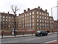
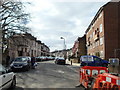
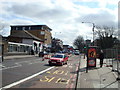
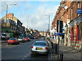
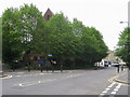
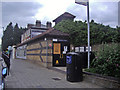
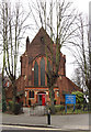
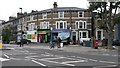

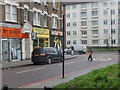

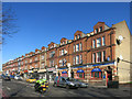
100 photos from this area
Area Information
Key information about the E5 8SR including its size, population, and administrative classification.
- Area Type
- Postcode
- Area Size
- 2999 m²
- Population
- 2303
- Population Density
- 21788 people/km²
House Prices in E5 8SR
65
Properties
£248,400
Average Sold Price
£85,000
Lowest Price
£475,000
Highest Price
Showing 65 properties
| Address | Type | Beds | Baths | Last Sale Price | Last Sale Date | |
|---|---|---|---|---|---|---|
| 52, Weald Square, Upper Clapton Road, Hackney, London, E5 8SR | Flat | 2 | 1 | £475,000 | Dec 2025 | |
| 24, Weald Square, Upper Clapton Road, Hackney, London, E5 8SR | Flat | - | - | £300,000 | Feb 2016 | |
| 48, Weald Square, Upper Clapton Road, Hackney, London, E5 8SR | Flat | - | - | £212,000 | May 2012 | |
| 57, Weald Square, Upper Clapton Road, Hackney, London, E5 8SR | Flat | - | - | £170,000 | Oct 2007 | |
| 3, Weald Square, Upper Clapton Road, Hackney, London, E5 8SR | Flat | - | - | £85,000 | Jan 2003 | |
| 9, Weald Square, Upper Clapton Road, London, E5 8SR | Flat | 1 | 1 | - | - | |
| 30, Weald Square, Upper Clapton Road, Hackney, London, E5 8SR | Flat | - | - | - | - | |
| 1, Weald Square, Upper Clapton Road, Hackney, London, E5 8SR | Flat | - | - | - | - | |
| 58, Weald Square, Upper Clapton Road, Hackney, London, E5 8SR | Flat | - | - | - | - | |
| 59, Weald Square, Upper Clapton Road, Hackney, London, E5 8SR | Flat | 2 | 1 | - | - |
Page 1 of 7
Energy Efficiency in E5 8SR
Amenities
Schools
| Rank | School | Type | Entry gender | Ages |
|---|
Explore more schools in this area
Go to Schools tabDemographics
Household Size
One person
most common
Accommodation Type
Flats
most common
Tenure
20
majority
Ethnic Group
White
most common
Religion
N/A
most common
Household Composition
N/A
most common
Age
47
median
Adults (30-64 years)
most common
Household Deprivation
N/A
with no deprivation
NS-SEC
32
in Lower managerial occupations
Explore more demographic insights in this area
Go to Demographics tabPlanning
Planning Constraints
- Flood RiskPremium
- Ramsar Wetland SitesPremium
- Area of Outstanding Natural BeautyPremium
- Protected Nature ReservePremium
- Protected WoodlandPremium