Area Overview for E5 8BP
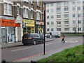
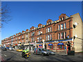
Photos of E5 8BP


Area Information
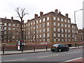
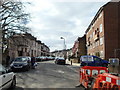
E5 8BP is a compact residential postcode in London, covering just 8,559 square metres and home to 1,714 residents. Its high population density of 200,251 people per square kilometre reflects a tightly knit community. The area’s character is defined by its mix of older housing stock, predominantly flats, and proximity to transport hubs. With a median age of 47, the population skews towards adults aged 30–64, suggesting a stable, established demographic. Daily life here is shaped by easy access to schools, shops, and public transport, with multiple rail, metro, and bus stops within reach. The digital infrastructure is robust, with broadband and mobile scores of 86 and 85 respectively, supporting both remote work and everyday connectivity. While the area lacks natural landscapes, its strategic location near Clapton and Hackney offers a blend of urban convenience and potential for leisure. For buyers, E5 8BP’s small size means limited land for new developments, but its existing amenities and transport links make it appealing for those prioritising accessibility over space.
- Area Type
- Postcode
- Area Size
- 8559 m²
- Population
- 1714
- Population Density
- 13236 people/km²
E5 8BP’s property market is characterised by a low home ownership rate of 25%, meaning most residents rent their homes. The accommodation is almost exclusively flats, reflecting the area’s high population density and limited land availability. This suggests a rental-dominated market with limited opportunities for owner-occupied properties. The small size of the postcode—just 8,559 square metres—means that new developments are constrained, and the existing housing stock is likely to be older, with fewer modern builds. For buyers, this could mean competition for the limited number of flats available, particularly if they are seeking a home in a central location. The proximity to transport hubs and amenities may offset the lack of space, making E5 8BP attractive to those prioritising convenience over property size. However, the rental market’s dominance may also indicate slower price growth compared to areas with higher ownership rates.
House Prices in E5 8BP
Showing 1 properties
| Address | Type | Beds | Baths | Last Sale Price | Last Sale Date | |
|---|---|---|---|---|---|---|
| Caretakers Flat, Brooke House Sixth Form College, Kenninghall Road, Hackney, London, E5 8BP | Flat | - | - | - | - |
Energy Efficiency in E5 8BP
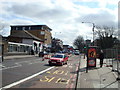
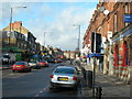
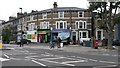
Life in E5 8BP is shaped by its proximity to a variety of retail, leisure, and transport hubs. Nearby supermarkets like Tesco Lower, Tesco Hackney, and Co-op Hackney provide essential shopping options, while the area’s rail and metro stations offer seamless access to London’s wider network. The presence of five ferry terminals, including Tower Bridge Quay, and London City Airport makes travel beyond the city straightforward. While the area lacks large parks or green spaces, the density of amenities suggests a focus on urban convenience. Residents can access multiple transport options, from buses to underground stations, supporting a dynamic lifestyle. The mix of retail and transport infrastructure means daily errands and commutes are efficient, though the compact postcode may require reliance on public transport for nearby leisure activities.
Amenities
Schools
The area is served by a range of educational institutions, including primary schools and a sixth-form college. Baden-Powell School is a primary school catering to younger children, while St Scholastica’s Catholic Primary School, rated ‘good’ by Ofsted, provides a faith-based alternative. Al-Falah Primary School, also rated ‘good’, offers an independent option for families seeking non-state education. The Brooke House Sixth Form College provides post-16 education, making the area suitable for those planning for both primary and secondary schooling. This mix of school types ensures families have choices, from state-funded to independent institutions. The presence of a sixth-form college also suggests the area supports students transitioning to higher education or vocational training. For parents, the combination of good Ofsted ratings and varied options may be a key consideration when evaluating E5 8BP as a place to live.
| Rank | School | Type | Entry gender | Ages |
|---|
Explore more schools in this area
Go to Schools tabDemographics
The population of E5 8BP is predominantly adults aged 30–64, with a median age of 47. This suggests a mature, stable community with a focus on established households rather than younger families or retirees. Home ownership is low, at just 25%, indicating that the majority of residents are likely to be renting. The accommodation type is almost entirely flats, which aligns with the area’s high density and compact layout. The predominant ethnic group is White, though no data on diversity beyond this is provided. The absence of specific deprivation statistics means it is unclear how economic factors might influence quality of life. However, the presence of multiple schools and transport options suggests a level of infrastructure that supports daily living. The community’s age profile and housing stock imply a focus on convenience over expansive living spaces, with a reliance on shared amenities and public services.
Household Size
Accommodation Type
Tenure
Ethnic Group
Religion
Household Composition
Age
Household Deprivation
NS-SEC
Explore more demographic insights in this area
Go to Demographics tabPlanning
Planning Constraints
- Flood RiskPremium
- Ramsar Wetland SitesPremium
- Area of Outstanding Natural BeautyPremium
- Protected Nature ReservePremium
- Protected WoodlandPremium