Area Overview for E5 0RW
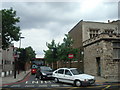
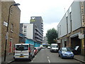
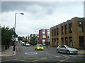
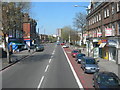
Photos of E5 0RW


Area Information
Living in E5 0RW means being part of a small, tightly knit residential cluster in north-east London. With a population of 1,773, this postcode area offers a quiet, community-focused environment, distinct from the city’s busier zones. The area’s compact size means residents are close to essential services, including retail, transport hubs, and green spaces. Daily life here is shaped by proximity to major transport routes, with rail, metro, and bus options within easy reach. The demographic profile suggests a mature community, with a median age of 47 and a strong presence of adults aged 30–64. This age group often prioritises stability, reflected in the area’s mix of owner-occupied and rented properties. While not a high-density urban space, E5 0RW is well-connected to London’s broader infrastructure, making it appealing to those seeking a balance between suburban comfort and city accessibility. The absence of major environmental constraints, such as protected woodlands or flood zones, adds to its practicality for families and professionals.
- Area Type
- Postcode
- Area Size
- Not available
- Population
- 1773
- Population Density
- 18335 people/km²
The property market in E5 0RW is characterised by a low home ownership rate of 44%, suggesting that renting is more common than buying in this small area. The primary accommodation type is houses, which, given the limited population, indicates a scarcity of available properties. This dynamic may make the housing stock feel exclusive, with limited options for buyers. The area’s compact size means that properties are likely to be in close proximity to one another, potentially creating a tight-knit community but also limiting expansion. For buyers, this suggests that the market is not highly competitive, but the small number of homes may mean fewer choices. The focus on houses rather than flats or apartments could appeal to those seeking more space, though the overall availability remains constrained by the area’s size.
House Prices in E5 0RW
No properties found in this postcode.
Energy Efficiency in E5 0RW
Residents of E5 0RW have access to a range of amenities within walking or short transit distance. Retail options include Co-op Clapton, Spar, and Tesco Lower, offering everyday shopping needs. The area’s transport links are extensive, with rail, metro, and bus services connecting to key destinations like Leyton, Bow Road, and London Victoria Coach Station. For leisure, ferry services to Canary Wharf and Tower Bridge provide waterfront access, while London City Airport is a short journey away. The mix of retail, transport, and travel options ensures a convenient lifestyle, balancing suburban tranquillity with urban accessibility. The presence of multiple stations and bus routes also supports a dynamic social life, with easy access to cultural and commercial hubs across London.
Amenities
Schools
The nearest school to E5 0RW is Paragon Christian Academy, an independent institution. This school type typically offers fee-paying education, which may be a consideration for families seeking private schooling. The absence of state-funded schools in the immediate vicinity means that residents must look beyond the postcode for public education options. For those prioritising independent education, Paragon Christian Academy provides a specific pathway, but its availability may not cater to all household budgets. The lack of multiple school types in the area suggests a limited choice for families, though the presence of one independent school indicates some level of educational infrastructure. Parents should verify whether the school’s curriculum and facilities align with their needs before relocating.
| Rank | School | Type | Entry gender | Ages |
|---|---|---|---|---|
| 1 | Paragon Christian Academy | independent | N/A | N/A |
Explore more schools in this area
Go to Schools tabDemographics
The community in E5 0RW is predominantly composed of adults aged 30–64, with a median age of 47. This suggests a mature population, likely with established careers and family structures. Home ownership here is relatively low at 44%, indicating a significant proportion of residents are renters, possibly due to the area’s limited housing stock. The accommodation type is primarily houses, which, given the small population, implies a low density of properties. The predominant ethnic group is White, though no further breakdown of diversity is provided. This demographic profile points to a stable, possibly middle-income community, where homeownership is not the norm. The absence of detailed data on deprivation means quality of life can only be inferred from the available statistics, such as the low crime risk and good digital connectivity.
Household Size
Accommodation Type
Tenure
Ethnic Group
Religion
Household Composition
Age
Household Deprivation
NS-SEC
Explore more demographic insights in this area
Go to Demographics tabPlanning
Planning Constraints
- Flood RiskPremium
- Ramsar Wetland SitesPremium
- Area of Outstanding Natural BeautyPremium
- Protected Nature ReservePremium
- Protected WoodlandPremium
- Crime RiskPremium