Area Overview for E5 0PR
Photos of E5 0PR


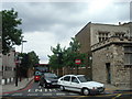
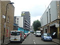
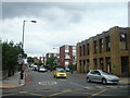


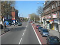

100 photos from this area
Area Information
Key information about the E5 0PR including its size, population, and administrative classification.
- Area Type
- Postcode
- Area Size
- 7064 m²
- Population
- 1582
- Population Density
- 9881 people/km²
House Prices in E5 0PR
53
Properties
£655,671
Average Sold Price
£99,000
Lowest Price
£1,350,000
Highest Price
Showing 53 properties
| Address | Type | Beds | Baths | Last Sale Price | Last Sale Date | |
|---|---|---|---|---|---|---|
| 161 Powerscroft Road, Hackney, London, E5 0PR | Terraced | 3 | 1 | £1,009,000 | Nov 2023 | |
| 167B Powerscroft Road, Hackney, London, E5 0PR | Terraced | 2 | - | £567,000 | Mar 2022 | |
| 150 Powerscroft Road, Hackney, London, E5 0PR | house | - | - | £1,290,000 | Jan 2021 | |
| 163 Powerscroft Road, Hackney, London, E5 0PR | house | - | - | £1,125,000 | Jan 2021 | |
| 175 Powerscroft Road, Hackney, London, E5 0PR | Terraced | 3 | 2 | £815,000 | Jul 2019 | |
| 155 Powerscroft Road, Hackney, London, E5 0PR | Terraced | 3 | 2 | £1,350,000 | Jul 2018 | |
| 151 Powerscroft Road, Hackney, London, E5 0PR | Terraced | 3 | 1 | £1,145,000 | Jul 2018 | |
| 144 Powerscroft Road, Hackney, London, E5 0PR | house | - | - | £1,170,250 | Jul 2017 | |
| 159 Powerscroft Road, Hackney, London, E5 0PR | Terraced | 3 | - | £568,000 | Apr 2013 | |
| 157 Powerscroft Road, Hackney, London, E5 0PR | house | 3 | - | £490,000 | Nov 2011 |
Page 1 of 6
Energy Efficiency in E5 0PR
Amenities
Schools
| Rank | School | Type | Entry gender | Ages |
|---|
Explore more schools in this area
Go to Schools tabDemographics
Household Size
Family (3-5 people)
most common
Accommodation Type
Flats
most common
Tenure
44
majority
Ethnic Group
White
most common
Religion
N/A
most common
Household Composition
N/A
most common
Age
47
median
Adults (30-64 years)
most common
Household Deprivation
N/A
with no deprivation
NS-SEC
47
in Lower managerial occupations
Explore more demographic insights in this area
Go to Demographics tabPlanning
Planning Constraints
- Flood RiskPremium
- Ramsar Wetland SitesPremium
- Area of Outstanding Natural BeautyPremium
- Protected Nature ReservePremium
- Protected WoodlandPremium