Area Overview for E5 0ND
Photos of E5 0ND
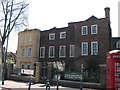

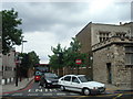
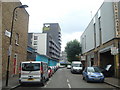
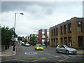


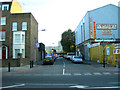

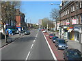

100 photos from this area
Area Information
Key information about the E5 0ND including its size, population, and administrative classification.
- Area Type
- Postcode
- Area Size
- 5355 m²
- Population
- 1872
- Population Density
- 12884 people/km²
House Prices in E5 0ND
33
Properties
£566,953
Average Sold Price
£81,000
Lowest Price
£1,080,000
Highest Price
Showing 33 properties
| Address | Type | Beds | Baths | Last Sale Price | Last Sale Date | |
|---|---|---|---|---|---|---|
| 84 Dunlace Road, Hackney, London, E5 0ND | Terraced | 3 | 1 | £1,020,000 | Mar 2025 | |
| 128 Dunlace Road, Hackney, London, E5 0ND | Terraced | 3 | 1 | £1,080,000 | Jul 2022 | |
| 92 Dunlace Road, Hackney, London, E5 0ND | house | 3 | - | £985,000 | Jan 2021 | |
| 90 Dunlace Road, Hackney, London, E5 0ND | Terraced | 3 | 2 | £945,745 | Oct 2019 | |
| 108 Dunlace Road, Hackney, London, E5 0ND | Detached | 3 | 1 | £940,000 | Jan 2019 | |
| 114 Dunlace Road, Hackney, London, E5 0ND | house | 2 | - | £933,000 | Oct 2017 | |
| 124 Dunlace Road, Hackney, London, E5 0ND | Terraced | 3 | 1 | £850,000 | Dec 2015 | |
| 132 Dunlace Road, Hackney, London, E5 0ND | Terraced | 3 | 2 | £540,000 | Oct 2012 | |
| 112 Dunlace Road, Hackney, London, E5 0ND | Terraced | 4 | 2 | £327,500 | Jan 2009 | |
| 98 Dunlace Road, Hackney, London, E5 0ND | Terraced | - | - | £315,000 | Jul 2006 |
Page 1 of 4
Energy Efficiency in E5 0ND
Amenities
Schools
| Rank | School | Type | Entry gender | Ages |
|---|
Explore more schools in this area
Go to Schools tabDemographics
Household Size
Family (3-5 people)
most common
Accommodation Type
Flats
most common
Tenure
40
majority
Ethnic Group
White
most common
Religion
N/A
most common
Household Composition
N/A
most common
Age
47
median
Adults (30-64 years)
most common
Household Deprivation
N/A
with no deprivation
NS-SEC
49
in Lower managerial occupations
Explore more demographic insights in this area
Go to Demographics tabPlanning
Planning Constraints
- Flood RiskPremium
- Ramsar Wetland SitesPremium
- Area of Outstanding Natural BeautyPremium
- Protected Nature ReservePremium
- Protected WoodlandPremium