Area Overview for E5 0DY
Photos of E5 0DY
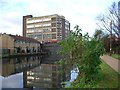
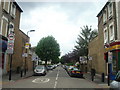
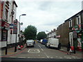
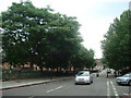


100 photos from this area
Area Information
Key information about the E5 0DY including its size, population, and administrative classification.
- Area Type
- Postcode
- Area Size
- 1.2 hectares
- Population
- 2224
- Population Density
- 1967 people/km²
House Prices in E5 0DY
57
Properties
£351,033
Average Sold Price
£44,000
Lowest Price
£860,000
Highest Price
Showing 57 properties
| Address | Type | Beds | Baths | Last Sale Price | Last Sale Date | |
|---|---|---|---|---|---|---|
| 20 Adley Street, Hackney, London, E5 0DY | Maisonette | 2 | 1 | £552,000 | Mar 2024 | |
| 44 Adley Street, Hackney, London, E5 0DY | Terraced | 3 | 1 | £750,000 | Oct 2023 | |
| 27 Adley Street, Hackney, London, E5 0DY | Flat | - | - | £510,000 | Jul 2023 | |
| 11 Adley Street, Hackney, London, E5 0DY | Flat | - | - | £562,000 | Jun 2023 | |
| 41 Adley Street, Hackney, London, E5 0DY | house | - | - | £860,000 | Nov 2022 | |
| 8 Adley Street, Hackney, London, E5 0DY | Retail | 2 | 1 | £480,000 | Jul 2022 | |
| 3 Adley Street, Hackney, London, E5 0DY | Maisonette | - | - | £550,000 | Feb 2021 | |
| 29 Adley Street, Hackney, London, E5 0DY | Flat | 2 | 1 | £437,500 | Sep 2020 | |
| 22 Adley Street, Hackney, London, E5 0DY | Flat | - | - | £510,000 | Mar 2020 | |
| 26 Adley Street, Hackney, London, E5 0DY | Flat | - | - | £440,000 | Nov 2017 |
Page 1 of 6
Energy Efficiency in E5 0DY
Amenities
Schools
| Rank | School | Type | Entry gender | Ages |
|---|
Explore more schools in this area
Go to Schools tabDemographics
Household Size
Family (3-5 people)
most common
Accommodation Type
Flats
most common
Tenure
20
majority
Ethnic Group
black_total
most common
Religion
N/A
most common
Household Composition
N/A
most common
Age
47
median
Adults (30-64 years)
most common
Household Deprivation
N/A
with no deprivation
NS-SEC
34
in Lower managerial occupations
Explore more demographic insights in this area
Go to Demographics tabPlanning
Planning Constraints
- Flood RiskPremium
- Ramsar Wetland SitesPremium
- Area of Outstanding Natural BeautyPremium
- Protected Nature ReservePremium
- Protected WoodlandPremium