Area Overview for E4 9NE
Photos of E4 9NE
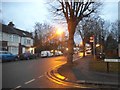
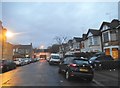
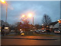
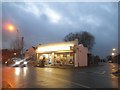
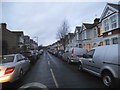
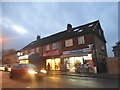
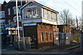
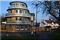
37 photos from this area
Area Information
Key information about the E4 9NE including its size, population, and administrative classification.
- Area Type
- Postcode
- Area Size
- 8361 m²
- Population
- 1753
- Population Density
- 14806 people/km²
House Prices in E4 9NE
18
Properties
£318,946
Average Sold Price
£79,800
Lowest Price
£682,000
Highest Price
Showing 18 properties
| Address | Type | Beds | Baths | Last Sale Price | Last Sale Date | |
|---|---|---|---|---|---|---|
| 172 Selwyn Avenue, Chingford, E4 9NE | Terraced | 3 | 1 | £635,000 | Jul 2025 | |
| 186 Selwyn Avenue, Chingford, E4 9NE | house | - | - | £682,000 | Jul 2024 | |
| 178 Selwyn Avenue, Chingford, E4 9NE | Terraced | 3 | 1 | £587,000 | Sep 2019 | |
| 166 Selwyn Avenue, Chingford, E4 9NE | Terraced | 1 | 1 | £435,000 | Sep 2018 | |
| 188A Selwyn Avenue, Chingford, E4 9NE | Terraced | 3 | 1 | £425,000 | Jan 2015 | |
| 192 Selwyn Avenue, Chingford, E4 9NE | Terraced | 3 | 1 | £295,000 | Apr 2014 | |
| 180 Selwyn Avenue, Chingford, E4 9NE | house | - | - | £265,000 | Jan 2011 | |
| 194 Selwyn Avenue, Chingford, E4 9NE | house | - | - | £245,000 | Nov 2006 | |
| 164 Selwyn Avenue, Chingford, E4 9NE | house | 3 | 1 | £237,000 | Jun 2005 | |
| 174 Selwyn Avenue, Chingford, E4 9NE | Terraced | - | - | £237,500 | Apr 2003 |
Page 1 of 2
Energy Efficiency in E4 9NE
Amenities
Schools
| Rank | School | Type | Entry gender | Ages |
|---|
Explore more schools in this area
Go to Schools tabDemographics
Household Size
Family (3-5 people)
most common
Accommodation Type
Flats
most common
Tenure
38
majority
Ethnic Group
White
most common
Religion
N/A
most common
Household Composition
N/A
most common
Age
47
median
Adults (30-64 years)
most common
Household Deprivation
N/A
with no deprivation
NS-SEC
29
in Lower managerial occupations
Explore more demographic insights in this area
Go to Demographics tabPlanning
Planning Constraints
- Flood RiskPremium
- Ramsar Wetland SitesPremium
- Area of Outstanding Natural BeautyPremium
- Protected Nature ReservePremium
- Protected WoodlandPremium