Area Overview for E4 8JG
Photos of E4 8JG
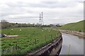
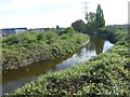
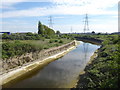
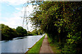
27 photos from this area
Area Information
Key information about the E4 8JG including its size, population, and administrative classification.
- Area Type
- Postcode
- Area Size
- 1.6 hectares
- Population
- 1816
- Population Density
- 5316 people/km²
House Prices in E4 8JG
17
Properties
£363,222
Average Sold Price
£154,000
Lowest Price
£570,000
Highest Price
Showing 17 properties
| Address | Type | Beds | Baths | Last Sale Price | Last Sale Date | |
|---|---|---|---|---|---|---|
| 21 Lower Hall Lane, Chingford, E4 8JG | Semi-detached | 3 | 1 | £500,000 | Oct 2024 | |
| 11 Lower Hall Lane, Chingford, E4 8JG | Retail | 3 | 1 | £570,000 | Jul 2022 | |
| 19 Lower Hall Lane, Chingford, E4 8JG | Terraced | 3 | - | £450,000 | Aug 2016 | |
| 27 Lower Hall Lane, Chingford, E4 8JG | Terraced | 3 | 1 | £454,000 | Jun 2016 | |
| 1 Lower Hall Lane, Chingford, E4 8JG | Terraced | 3 | 1 | £375,000 | Aug 2014 | |
| 17 Lower Hall Lane, Chingford, E4 8JG | house | - | - | £270,000 | Dec 2012 | |
| 15 Lower Hall Lane, Chingford, E4 8JG | Terraced | 3 | 1 | £249,000 | Oct 2011 | |
| 3 Lower Hall Lane, Chingford, E4 8JG | Terraced | 3 | 1 | £247,000 | Mar 2005 | |
| 23 Lower Hall Lane, Chingford, E4 8JG | house | - | - | £154,000 | Feb 2000 | |
| 25 Lower Hall Lane, Chingford, E4 8JG | Terraced | 4 | 2 | - | - |
Page 1 of 2
Energy Efficiency in E4 8JG
Amenities
Schools
| Rank | School | Type | Entry gender | Ages |
|---|
Explore more schools in this area
Go to Schools tabDemographics
Household Size
Family (3-5 people)
most common
Accommodation Type
Houses
most common
Tenure
68
majority
Ethnic Group
White
most common
Religion
N/A
most common
Household Composition
N/A
most common
Age
47
median
Adults (30-64 years)
most common
Household Deprivation
N/A
with no deprivation
NS-SEC
26
in Lower managerial occupations
Explore more demographic insights in this area
Go to Demographics tabPlanning
Planning Constraints
- Flood RiskPremium
- Ramsar Wetland SitesPremium
- Area of Outstanding Natural BeautyPremium
- Protected Nature ReservePremium
- Protected WoodlandPremium