Area Overview for E4 7DJ
Photos of E4 7DJ
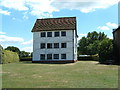


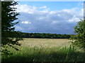
![Housing on Connaught Avenue, Chingford [1] in E4 7DJ](https://images.propbar.co.uk/images/geograph/47/91/4791722_120.jpg)

100 photos from this area
Area Information
Key information about the E4 7DJ including its size, population, and administrative classification.
- Area Type
- Postcode
- Area Size
- 3622 m²
- Population
- 1965
- Population Density
- 6436 people/km²
House Prices in E4 7DJ
25
Properties
£421,914
Average Sold Price
£59,000
Lowest Price
£630,000
Highest Price
Showing 25 properties
| Address | Type | Beds | Baths | Last Sale Price | Last Sale Date | |
|---|---|---|---|---|---|---|
| 3 Springfield Road, Chingford, E4 7DJ | Semi-detached | 3 | 1 | £577,500 | Jan 2025 | |
| 10 Springfield Road, Chingford, E4 7DJ | Terraced | 4 | 2 | £579,011 | Oct 2024 | |
| 12 Springfield Road, Chingford, E4 7DJ | Terraced | 3 | 2 | £630,000 | May 2024 | |
| 17 Springfield Road, Chingford, E4 7DJ | Semi-detached | 3 | 1 | £420,000 | Oct 2023 | |
| 19 Springfield Road, Chingford, E4 7DJ | house | - | - | £570,000 | Mar 2023 | |
| 13 Springfield Road, Chingford, E4 7DJ | Retail | 3 | 2 | £570,000 | Jun 2022 | |
| 14 Springfield Road, Chingford, E4 7DJ | Terraced | 2 | 1 | £525,000 | Mar 2022 | |
| 20 Springfield Road, Chingford, E4 7DJ | Semi-detached | 2 | - | £525,000 | Nov 2020 | |
| 22 Springfield Road, Chingford, E4 7DJ | Terraced | 3 | 1 | £540,000 | Oct 2020 | |
| 16 Springfield Road, Chingford, E4 7DJ | Terraced | 3 | 1 | £486,032 | Aug 2018 |
Page 1 of 3
Energy Efficiency in E4 7DJ
Amenities
Schools
| Rank | School | Type | Entry gender | Ages |
|---|
Explore more schools in this area
Go to Schools tabDemographics
Household Size
Family (3-5 people)
most common
Accommodation Type
Houses
most common
Tenure
65
majority
Ethnic Group
White
most common
Religion
N/A
most common
Household Composition
N/A
most common
Age
47
median
Adults (30-64 years)
most common
Household Deprivation
N/A
with no deprivation
NS-SEC
42
in Lower managerial occupations
Explore more demographic insights in this area
Go to Demographics tabPlanning
Planning Constraints
- Flood RiskPremium
- Ramsar Wetland SitesPremium
- Area of Outstanding Natural BeautyPremium
- Protected Nature ReservePremium
- Protected WoodlandPremium