Area Overview for E4 6UW
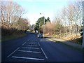
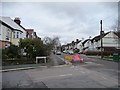
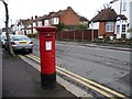
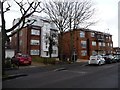
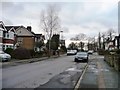
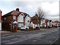
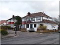
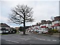
Photos of E4 6UW

Area Information
E4 6UW is a small, densely populated residential cluster in England, covering just 1,592 square metres. Despite its compact size, it accommodates 1,543 residents, resulting in a population density of nearly 969,000 people per square kilometre. This area is characterised by its proximity to transport hubs and retail centres, making it a practical choice for those prioritising connectivity. The community here is predominantly composed of adults aged 30–64, with a median age of 47, suggesting a mature, established population. Daily life in E4 6UW is shaped by its accessibility to major railway lines, underground stations, and local shops. The area’s small footprint means it is tightly integrated with surrounding districts, offering a balance of urban convenience and residential tranquillity. While the population density is exceptionally high, the presence of multiple rail and bus services ensures that residents can easily navigate to nearby amenities, from supermarkets to employment centres. For buyers, E4 6UW represents a focused, compact living environment where proximity to transport and retail is prioritised over expansive open spaces.
- Area Type
- Postcode
- Area Size
- 1592 m²
- Population
- 1543
- Population Density
- 4694 people/km²
The property market in E4 6UW is defined by a 48% home ownership rate, suggesting that nearly half of the properties are owner-occupied, while the remaining 52% are likely rented. The accommodation type is predominantly houses, which contrasts with areas where flats or apartments dominate. This indicates a housing stock that may cater to families or individuals seeking more space, though the small area size of 1,592 square metres suggests limited land for new developments. The high population density, combined with the prevalence of houses, may create a competitive market for buyers, particularly those seeking properties in a compact, transport-linked area. Given the proximity to multiple rail and underground stations, E4 6UW could be an attractive option for commuters, though buyers should consider the potential for higher property prices in such a densely populated, well-connected location. The immediate surroundings may offer additional housing options, but the area’s small size means that availability is likely constrained.
House Prices in E4 6UW
Showing 1 properties
| Address | Type | Beds | Baths | Last Sale Price | Last Sale Date | |
|---|---|---|---|---|---|---|
| Ainslie Rehabilitation Centre, 3 Friars Close, Chingford, E4 6UW | hospital_care_home | - | - | - | - |
Energy Efficiency in E4 6UW
Living in E4 6UW offers access to a range of amenities within walking or short transit distance. The area is served by five retail outlets, including Tesco Chingford, Co-op Hatch, and Iceland Chingford, providing everyday shopping convenience. Multiple rail and underground stations—such as Highams Park, Chingford, and South Woodford—ensure easy access to London’s employment hubs and cultural centres. The Whipps Cross Bus Interchange adds flexibility for those preferring public transport. While the area lacks large parks or leisure facilities, its proximity to transport links means residents can quickly reach destinations beyond the immediate postcode. The compact nature of E4 6UW fosters a practical, efficient lifestyle, where daily errands and commutes are streamlined. This density of services supports a dynamic, connected community, though it may lack the green spaces preferred by some.
Amenities
Schools
| Rank | School | Type | Entry gender | Ages |
|---|
Explore more schools in this area
Go to Schools tabDemographics
The demographic profile of E4 6UW reflects a community of adults, with 47% of residents aged between 30 and 64, and a median age of 47. This suggests a population that is largely in their prime working years, potentially influencing local economic activity and housing demand. Home ownership in the area stands at 48%, indicating a slight majority of owner-occupied properties, though the remaining 52% are likely rented. The accommodation type is predominantly houses, which may appeal to families or those seeking more space than flats. The predominant ethnic group is White, though specific data on diversity is not provided. The high population density—nearly 970,000 people per square kilometre—raises questions about the quality of life, though the area’s transport links and amenities may mitigate the challenges of living in such a compact space. This density could foster a strong sense of community, though it may also contribute to pressure on local services and infrastructure.
Household Size
Accommodation Type
Tenure
Ethnic Group
Religion
Household Composition
Age
Household Deprivation
NS-SEC
Explore more demographic insights in this area
Go to Demographics tabPlanning
Planning Constraints
- Flood RiskPremium
- Ramsar Wetland SitesPremium
- Area of Outstanding Natural BeautyPremium
- Protected Nature ReservePremium
- Protected WoodlandPremium