Area Overview for E3 5UT
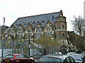
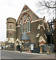
Photos of E3 5UT


Area Information
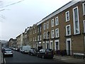
Living in E3 5UT means inhabiting a compact residential cluster in east London, where the population of 2,561 residents reflects a tight-knit community. The area’s character is defined by its proximity to transport hubs and a mix of urban convenience. Daily life here is shaped by practicality, with residents navigating a blend of historic and modern infrastructure. The postcode’s small size means amenities and services are within walking or short transit distance, though the area lacks expansive green spaces. E3 5UT sits at the intersection of regeneration and established neighbourhoods, offering a base for those prioritising connectivity over sprawling landscapes. While it is not a high-rise district, the housing stock is predominantly flats, reflecting a rental-oriented market. The median age of 47 suggests a mature population, with many residents in their 30s to 60s. For those seeking a place with accessible transport and a functional layout, E3 5UT provides a straightforward, no-frills living environment.
- Area Type
- Postcode
- Area Size
- Not available
- Population
- 2561
- Population Density
- 4469 people/km²
The property market in E3 5UT is characterised by a high proportion of rental properties, with only 43% of homes owned by residents. The accommodation type is predominantly flats, which are more common in urban areas with limited space for larger housing. This suggests a market skewed towards short-term lets or private rentals, with fewer opportunities for long-term ownership. The small size of the area means the housing stock is limited, and buyers may find competition for available properties. Flats in E3 5UT are likely to be older, with potential for renovation or redevelopment, though no specific data on property values or renovation trends is available. For those considering purchase, the area’s proximity to transport links and retail hubs may offset its lack of spacious housing. However, the rental-oriented nature of the market means buyers should assess whether the area aligns with long-term investment goals.
House Prices in E3 5UT
No properties found in this postcode.
Energy Efficiency in E3 5UT
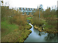
E3 5UT’s lifestyle is defined by its proximity to retail, transport, and leisure options. The area is within walking distance of five retail outlets, including Tesco Bow and Iceland Bow, offering everyday shopping needs. Transport hubs like Mile End Station and Hackney Wick Station provide easy access to London’s transport network, while ferry piers such as Canary Wharf Pier connect to the Thames. For those preferring public transport, four bus routes and three rail lines are within reach, including Cambridge Heath Station and Bethnal Green Railway Station. London City Airport is a short journey away, catering to frequent flyers. The area’s character is urban and practical, with no expansive parks or leisure facilities listed in the data. Residents rely on nearby transport links and retail hubs for convenience, though the absence of detailed information on green spaces or cultural amenities means lifestyle choices are largely dictated by proximity to infrastructure.
Amenities
Schools
The nearest school to E3 5UT is Chisenhale Primary School, a primary institution with an Ofsted rating of ‘good’. This single school serves the area’s younger residents, though no secondary schools are listed in the data. The presence of a primary school with a positive rating indicates a baseline level of education quality for families with children aged 4–11. However, the absence of secondary schools nearby may require students to commute to neighbouring areas for further education. For parents prioritising schools, Chisenhale Primary’s rating suggests it meets acceptable standards, but the limited range of educational options means families may need to consider broader catchment areas. The school’s proximity to E3 5UT makes it a practical choice for local families, though no additional details on its curriculum or facilities are available.
| Rank | School | Type | Entry gender | Ages |
|---|
Explore more schools in this area
Go to Schools tabDemographics
The community in E3 5UT is predominantly composed of adults aged 30–64, with a median age of 47. Home ownership rates here stand at 43%, significantly below the national average, indicating a rental-heavy market. The accommodation type is almost exclusively flats, reflecting a lack of detached or semi-detached housing. The predominant ethnic group is White, though no data is provided on the proportion of other groups. The age profile suggests a population settled in careers and family life, with fewer young children or retirees. This demographic balance means local services cater to working-age adults, with schools and amenities tailored to families. The lower home ownership rate implies a transient population, with renters possibly moving in and out of the area. The absence of specific data on deprivation levels means quality of life factors like access to healthcare or leisure remain unquantified, though transport and retail options suggest basic needs are met.
Household Size
Accommodation Type
Tenure
Ethnic Group
Religion
Household Composition
Age
Household Deprivation
NS-SEC
Explore more demographic insights in this area
Go to Demographics tabPlanning
Planning Constraints
- Flood RiskPremium
- Ramsar Wetland SitesPremium
- Area of Outstanding Natural BeautyPremium
- Protected Nature ReservePremium
- Protected WoodlandPremium