Area Overview for E3 4JF
Photos of E3 4JF
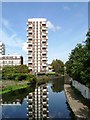
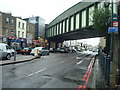
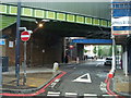
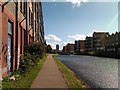


100 photos from this area
Area Information
Key information about the E3 4JF including its size, population, and administrative classification.
- Area Type
- Postcode
- Area Size
- 1.4 hectares
- Population
- 2463
- Population Density
- 25683 people/km²
House Prices in E3 4JF
56
Properties
£230,500
Average Sold Price
£66,000
Lowest Price
£440,000
Highest Price
Showing 56 properties
| Address | Type | Beds | Baths | Last Sale Price | Last Sale Date | |
|---|---|---|---|---|---|---|
| 140 Wager Street, London, E3 4JF | Maisonette | - | - | £250,000 | Aug 2025 | |
| 142 Wager Street, London, E3 4JF | Maisonette | 2 | 1 | £365,000 | Nov 2023 | |
| 168 Wager Street, London, E3 4JF | Maisonette | 4 | 1 | £440,000 | Jul 2022 | |
| 120 Wager Street, London, E3 4JF | Maisonette | 1 | 2 | £375,000 | May 2017 | |
| 108 Wager Street, London, E3 4JF | Maisonette | 3 | 1 | £420,000 | Oct 2016 | |
| 122 Wager Street, London, E3 4JF | Maisonette | - | - | £330,000 | Oct 2015 | |
| 80 Wager Street, London, E3 4JF | Maisonette | 3 | 1 | £365,000 | Aug 2015 | |
| 116 Wager Street, London, E3 4JF | Maisonette | - | - | £245,000 | Aug 2012 | |
| 178 Wager Street, London, E3 4JF | Maisonette | - | - | £202,000 | Jul 2010 | |
| 132 Wager Street, London, E3 4JF | Maisonette | - | - | £230,000 | Dec 2009 |
Page 1 of 6
Energy Efficiency in E3 4JF
Amenities
Schools
| Rank | School | Type | Entry gender | Ages |
|---|
Explore more schools in this area
Go to Schools tabDemographics
Household Size
Family (3-5 people)
most common
Accommodation Type
Flats
most common
Tenure
34
majority
Ethnic Group
asian_total
most common
Religion
N/A
most common
Household Composition
N/A
most common
Age
47
median
Adults (30-64 years)
most common
Household Deprivation
N/A
with no deprivation
NS-SEC
39
in Lower managerial occupations
Explore more demographic insights in this area
Go to Demographics tabPlanning
Planning Constraints
- Flood RiskPremium
- Ramsar Wetland SitesPremium
- Area of Outstanding Natural BeautyPremium
- Protected Nature ReservePremium
- Protected WoodlandPremium