Area Overview for E3 4AL
Photos of E3 4AL
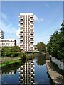
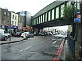
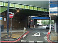
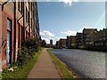


100 photos from this area
Area Information
Key information about the E3 4AL including its size, population, and administrative classification.
- Area Type
- Postcode
- Area Size
- 8500 m²
- Population
- 2668
- Population Density
- 28144 people/km²
House Prices in E3 4AL
91
Properties
£293,393
Average Sold Price
£50,500
Lowest Price
£470,000
Highest Price
Showing 91 properties
| Address | Type | Beds | Baths | Last Sale Price | Last Sale Date | |
|---|---|---|---|---|---|---|
| 86 St Pauls Way, London, E3 4AL | Flat | - | - | £318,000 | Mar 2017 | |
| Flat 23, Linton House, St Pauls Way, London, E3 4AL | Flat | - | - | £420,000 | Aug 2016 | |
| Flat 7, Printon House, Wallwood Street, London, E3 4AL | Flat | - | - | £340,000 | Jul 2016 | |
| Flat 56, Printon House, Wallwood Street, London, E3 4AL | Flat | - | - | £320,000 | Jun 2016 | |
| Flat 30, Printon House, Wallwood Street, London, E3 4AL | Maisonette | 4 | - | £420,000 | May 2016 | |
| Flat 20, Printon House, Wallwood Street, London, E3 4AL | Flat | - | - | £470,000 | Apr 2016 | |
| Flat 20, Linton House, St Pauls Way, London, E3 4AL | Flat | - | - | £470,000 | Feb 2016 | |
| Flat 21, Linton House, St Pauls Way, London, E3 4AL | Flat | - | - | £385,000 | Nov 2015 | |
| Flat 19, Linton House, St Pauls Way, London, E3 4AL | Flat | - | - | £385,000 | Aug 2015 | |
| 64 St Pauls Way, London, E3 4AL | Maisonette | 1 | 1 | £167,000 | Feb 2008 |
Page 1 of 10
Energy Efficiency in E3 4AL
Amenities
Schools
| Rank | School | Type | Entry gender | Ages |
|---|
Explore more schools in this area
Go to Schools tabDemographics
Household Size
Family (3-5 people)
most common
Accommodation Type
Flats
most common
Tenure
27
majority
Ethnic Group
asian_total
most common
Religion
N/A
most common
Household Composition
N/A
most common
Age
47
median
Adults (30-64 years)
most common
Household Deprivation
N/A
with no deprivation
NS-SEC
27
in Lower managerial occupations
Explore more demographic insights in this area
Go to Demographics tabPlanning
Planning Constraints
- Flood RiskPremium
- Ramsar Wetland SitesPremium
- Area of Outstanding Natural BeautyPremium
- Protected Nature ReservePremium
- Protected WoodlandPremium