Area Overview for E20 1DB
Photos of E20 1DB

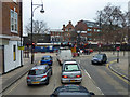
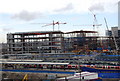


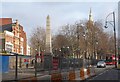

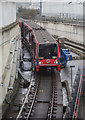
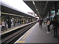
100 photos from this area
Area Information
Key information about the E20 1DB including its size, population, and administrative classification.
- Area Type
- Postcode
- Area Size
- 7.7 hectares
- Population
- 1536
- Population Density
- 41070 people/km²
House Prices in E20 1DB
9
Properties
-
Average Sold Price
-
Lowest Price
-
Highest Price
Showing 9 properties
| Address | Type | Beds | Baths | Last Sale Price | Last Sale Date | |
|---|---|---|---|---|---|---|
| 84 Celebration Avenue, Stratford, London, E20 1DB | Retail | - | - | - | - | |
| Chobham Academy Community Sports Facility, Temple Mill Lane, Stratford, London, E20 1DB | Leisure | - | - | - | - | |
| Community Sauna, Rear Of 38, Celebration Avenue, Stratford, London, E20 1DB | Leisure | - | - | - | - | |
| The Gantry Hotel, 40 Celebration Avenue, Stratford, London, E20 1DB | hotel | - | - | - | - | |
| 85 Celebration Avenue, Stratford, London, E20 1DB | retail_financial | - | - | - | - | |
| 87 Celebration Avenue, Stratford, London, E20 1DB | Office | - | - | - | - | |
| The Lighthouse & Gardens, 38 Celebration Avenue, Stratford, London, E20 1DB | commercial | - | - | - | - | |
| 75 Celebration Avenue, Stratford, London, E20 1DB | retail_financial | - | - | - | - | |
| Site Offices, Plot N08, Celebration Avenue, Stratford, London, E20 1DB | Office | - | - | - | - |
Energy Efficiency in E20 1DB
Amenities
Schools
| Rank | School | Type | Entry gender | Ages |
|---|
Explore more schools in this area
Go to Schools tabDemographics
Household Size
Two person
most common
Accommodation Type
Flats
most common
Tenure
15
majority
Ethnic Group
White
most common
Religion
N/A
most common
Household Composition
N/A
most common
Age
22
median
Adults (30-64 years)
most common
Household Deprivation
N/A
with no deprivation
NS-SEC
58
in Lower managerial occupations
Explore more demographic insights in this area
Go to Demographics tabPlanning
Planning Constraints
- Flood RiskPremium
- Ramsar Wetland SitesPremium
- Area of Outstanding Natural BeautyPremium
- Protected Nature ReservePremium
- Protected WoodlandPremium