Area Overview for E2 9RS
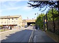
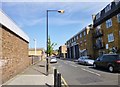
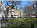
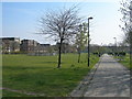
Photos of E2 9RS


Area Information
E2 9RS is a small residential cluster in east London, home to 1,695 people. This postcode sits in a densely populated urban environment, with a focus on flats rather than detached homes. The area is defined by its proximity to transport hubs, including multiple rail, metro, and bus routes, making it well-connected to central London and beyond. Daily life here revolves around convenience, with shops, schools, and public transport within walking or short-vehicle distance. The community is largely composed of adults aged 30–64, reflecting a mature demographic. While the area lacks natural landscapes or protected sites, its strategic location near Bethnal Green and the Thames offers access to cultural and commercial amenities. Living in E2 9RS means navigating a compact, urban environment with a strong emphasis on connectivity and accessibility, though the small size of the postcode means the character of the area is shaped more by its immediate surroundings than by distinct local landmarks.
- Area Type
- Postcode
- Area Size
- Not available
- Population
- 1695
- Population Density
- 24565 people/km²
The property market in E2 9RS is characterised by a high proportion of rental properties, with only 21% of homes owned by residents. This suggests that the area functions more as a rental market than an owner-occupied one, which may influence the types of properties available. The accommodation is predominantly flats, a common feature in urban areas with limited space for larger housing. For buyers, this means the market is likely to consist of smaller, purpose-built apartments rather than detached or semi-detached homes. The small size of the postcode means that property choices are limited to the immediate cluster, with little variation in housing stock. Prospective buyers should consider the area’s proximity to transport and amenities as key selling points, though the lack of unique architectural features or historical significance may not appeal to those seeking distinct properties.
House Prices in E2 9RS
No properties found in this postcode.
Energy Efficiency in E2 9RS
Living in E2 9RS grants access to a range of amenities within walking or short-vehicle distance. Retail options include Iceland Bethnal, Sainsburys Bethnal, and Tesco Bethnal, providing everyday shopping needs. The area’s transport links connect residents to major hubs like London City Airport, Tower Bridge Quay, and Wapping Pier, facilitating travel for work or leisure. Public transport is extensive, with five rail stations, five metro stops, and multiple bus routes nearby. While the data does not mention parks or leisure facilities, the proximity to the Thames and surrounding urban areas suggests opportunities for outdoor activities. The presence of a primary school and retail outlets indicates a functional, community-focused lifestyle, though the absence of specific leisure venues may require residents to venture further for cultural or recreational pursuits.
Amenities
Schools
The nearest school to E2 9RS is Raine’s Foundation School, a primary school serving the local community. While no secondary schools are listed in the data, the presence of a primary school suggests that families with young children may find the area suitable for early education. However, the absence of secondary school options within the postcode could necessitate travel for older students. The single school listed indicates a limited range of educational institutions, which may be a consideration for families requiring multiple school choices. The quality of education at Raine’s Foundation School is not specified, but its existence supports the area’s appeal to households with children.
| Rank | School | Type | Entry gender | Ages |
|---|
Explore more schools in this area
Go to Schools tabDemographics
The population of E2 9RS has a median age of 47, with the majority of residents falling into the 30–64 age range. This suggests a community of working-age adults, many of whom may be employed in nearby sectors such as retail, transport, or professional services. Home ownership is low, at 21%, indicating that most residents rent their homes. The predominant accommodation type is flats, reflecting the area’s urban density. The predominant ethnic group is Asian, though specific subgroups are not detailed in the data. This demographic profile points to a stable, established community with a focus on affordability and proximity to services. The lack of specific data on deprivation means that quality of life here is likely shaped by the availability of amenities and transport, rather than socioeconomic factors.
Household Size
Accommodation Type
Tenure
Ethnic Group
Religion
Household Composition
Age
Household Deprivation
NS-SEC
Explore more demographic insights in this area
Go to Demographics tabPlanning
Planning Constraints
- Flood RiskPremium
- Ramsar Wetland SitesPremium
- Area of Outstanding Natural BeautyPremium
- Protected Nature ReservePremium
- Protected WoodlandPremium