Area Overview for E2 0SR
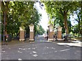
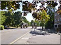
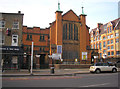
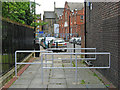
Photos of E2 0SR


Area Information
Living in E2 0SR means being part of a compact, residential postcode area in east London with a population of 2,516. This small cluster of homes is served by a range of transport links, including five metro stations, five rail stops, and ferry piers near Canary Wharf. The area’s proximity to London City Airport and major roads like the A13 makes it accessible for commuters. Daily life here is shaped by its urban setting, with nearby amenities such as Co-op Tower and Mile End Station providing convenience. The community is largely composed of adults aged 30–64, reflecting a mature demographic. While the area lacks natural beauty designations like AONB or protected woodlands, its practical connectivity and low crime risk—scoring 82/100—make it a stable choice for those prioritising safety and accessibility. E2 0SR is not a sprawling suburb but a tightly knit postcode where proximity to retail, transport, and employment hubs defines the rhythm of daily living.
- Area Type
- Postcode
- Area Size
- Not available
- Population
- 2516
- Population Density
- 34560 people/km²
The property market in E2 0SR is characterised by a high proportion of flats, with home ownership at 41%. This suggests a rental market dominates, though owner-occupiers are present. The small postcode area’s limited size means housing stock is concentrated, with little scope for expansion. Buyers should consider that flats may be the primary option, though proximity to transport hubs like Mile End and Stepney Green stations could enhance property value. The area’s appeal lies in its connectivity rather than architectural diversity. For those seeking a compact, urban lifestyle with easy access to London’s infrastructure, E2 0SR offers practicality over grandeur. However, the lack of larger homes or detached properties may limit options for families or those preferring more space.
House Prices in E2 0SR
No properties found in this postcode.
Energy Efficiency in E2 0SR
Residents of E2 0SR have access to a range of amenities within practical reach. Retail options include Co-op Tower, Co-op University of, and Co-op Mile, providing everyday shopping convenience. Transport hubs like Mile End Station and Bethnal Green Railway Station connect to central London, while ferry piers near Canary Wharf offer alternative routes. The area’s proximity to London City Airport and major roads like the A13 enhances its utility for commuters. For leisure, nearby parks and green spaces are not explicitly listed, but the absence of planning constraints like AONB or protected woodlands suggests a focus on urban living. The mix of retail, transport, and employment links creates a functional lifestyle, though the area’s character is defined more by its practicality than by natural or cultural landmarks.
Amenities
Schools
| Rank | School | Type | Entry gender | Ages |
|---|
Explore more schools in this area
Go to Schools tabDemographics
The community in E2 0SR is predominantly made up of adults aged 30–64, with a median age of 47. Home ownership here is relatively low, at 41%, suggesting a mix of renters and owner-occupiers. The accommodation type is largely flats, reflecting a housing stock suited to urban living. The predominant ethnic group is White, though specific diversity metrics are not provided. This age profile indicates a population focused on stability, with many likely in their peak working years. The absence of detailed deprivation data means it is unclear how economic pressures might affect quality of life, but the low crime risk and practical transport links suggest a functional, if unremarkable, environment for residents.
Household Size
Accommodation Type
Tenure
Ethnic Group
Religion
Household Composition
Age
Household Deprivation
NS-SEC
Explore more demographic insights in this area
Go to Demographics tabPlanning
Planning Constraints
- Flood RiskPremium
- Ramsar Wetland SitesPremium
- Area of Outstanding Natural BeautyPremium
- Protected Nature ReservePremium
- Protected WoodlandPremium