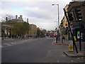
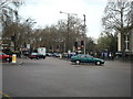
Area Overview for E2 0QG
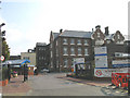
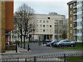
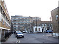
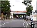
Photos of E2 0QG


Area Information
Living in E2 0QG means residing within a compact residential cluster covering just over 7,500 square metres. This tiny postcode serves 1,785 people, resulting in one of the highest population densities in the country. The sheer density shapes daily life, creating an urban environment where neighbours are rarely far away. You will find this small area embedded in East London, surrounded by significant transport hubs and commercial activity. The location prioritises convenience over space, as the community relies heavily on nearby infrastructure for daily needs. Residents benefit from immediate access to multiple railway stations, bus interchanges, and ferry piers. This concentration of services supports a fast-paced lifestyle suited to professionals and commuters. The area functions as a stepping stone or a compact home base within a larger, vibrant district. You can walk to major retail outlets and entertainment centres without needing a car. The environment is distinctly urban, offering a high-connection lifestyle typical of central London metropolitan zones.
- Area Type
- Postcode
- Area Size
- 7543 m²
- Population
- 1785
- Population Density
- 18196 people/km²
Homes in E2 0QG are mostly flats, which aligns with the limited availability of land in this 7,543 square metre postcode. The housing stock reflects a urban-centric design where vertical living replaces sprawling gardens. With only 25% of residents owning their homes, the area is predominantly a rental market. This dynamic means you will likely encounter a high volume of tenants rather than owner-occupiers. Buyers looking for properties here should focus on leasehold flats common in dense London districts. The lower ownership rate suggests strong demand from renters, including young professionals and students. While the area attracts new buyers due to its proximity to transport links, competition for purchase may be fierce. The high population density dictates that homes will be compact and efficient in their use of space. You will not find detached houses or large semi-detached family homes in this specific postcode. Instead, the market is defined by availability, rental yield, and accessibility for commuters.
House Prices in E2 0QG
Showing 60 properties
Energy Efficiency in E2 0QG
Daily life in E2 0QG centres on proximity to key amenities located within easy reach. You have access to five retail outlets, including the Co-op Tower and Sainsburys Stepney. Shopping needs are met without leaving the broader neighbourhood. Transport options are equally extensive, with five metro stations like Stepney Green and Mile End right nearby. Five railway stations, including Bethnal Green and Limehouse, offer rail travel. Leisure and travel options are plentiful. Five ferry piers are accessible, leading to Canary Wharf and Wapping. Four bus routes serve the area, with major interchanges at Whipps Cross and Green Line Coach Station. London City Airport is one airport away, facilitating quick flights. This density of amenities means you do not need a car for most daily activities. The area caters to those who value convenience and immediate access to London's commercial and transport hubs.
Amenities
Schools
There is one educational institution listed as near to E2 0QG. Rachel Keeling Nursery School serves the young children in the area as a nursery facility. As this is the only school with data available for this specific location, there are no primary, secondary, or further education institutions within the immediate geographical scope. Families looking for schools near E2 0QG must look beyond the immediate 7,543 square metre cluster. The presence of a nursery indicates a focus on early years care, which suits the demographic profile with a median age of 22. However, parents with older children need to research nearby borough schools as they fall outside the direct data for this postcode. The lack of data for larger school establishments suggests that E2 0QG functions as a residential feeder zone for larger complexes in surrounding areas. Residents plan childcare around the available nursery while arranging education for older children through the broader East London school network.
| Rank | School | Type | Entry gender | Ages |
|---|
Explore more schools in this area
Go to Schools tabDemographics
The community in E2 0QG is youthful, with a median age of 22 years. Despite the low median age, the most common age group consists of adults between 30 and 64 years. This demographic mix suggests a population that includes young professionals and young families moving into the city. Housing affordability likely drives many younger residents to choose this location over more spacious suburbs. Home ownership stands at 25%, meaning three-quarters of residents rent their homes. This statistic confirms E2 0QG operates largely as a rental market. Consequently, turnover rates may be higher than in areas dominated by owner-occupiers. The primary accommodation type found here is flats, reflecting the limited land area and high density. The predominant ethnic group in the area is Asian, which shapes the local culture and influences nearby retail offerings. This diversity contributes to a specific cultural character within the small cluster. The tight-knit nature of the community is evident in the high number of people living in such a small physical space.
Household Size
Accommodation Type
Tenure
Ethnic Group
Religion
Household Composition
Age
Household Deprivation
NS-SEC
Explore more demographic insights in this area
Go to Demographics tabPlanning
Planning Constraints
- Flood RiskPremium
- Ramsar Wetland SitesPremium
- Area of Outstanding Natural BeautyPremium
- Protected Nature ReservePremium
- Protected WoodlandPremium