Area Overview for E2 0BT
Photos of E2 0BT


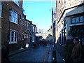


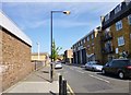

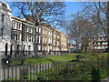
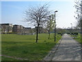


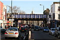
100 photos from this area
Area Information
Key information about the E2 0BT including its size, population, and administrative classification.
- Area Type
- Postcode
- Area Size
- 4.8 hectares
- Population
- 1629
- Population Density
- 9891 people/km²
House Prices in E2 0BT
66
Properties
£208,921
Average Sold Price
£45,286
Lowest Price
£470,000
Highest Price
Showing 66 properties
| Address | Type | Beds | Baths | Last Sale Price | Last Sale Date | |
|---|---|---|---|---|---|---|
| 113 Wilmot Street, London, E2 0BT | Flat | 1 | 1 | £390,000 | Jan 2025 | |
| 107 Wilmot Street, London, E2 0BT | Flat | - | - | £367,500 | Dec 2024 | |
| 106 Wilmot Street, London, E2 0BT | Flat | - | - | £380,000 | May 2024 | |
| 97 Wilmot Street, London, E2 0BT | Flat | - | - | £345,000 | Mar 2024 | |
| 109 Wilmot Street, London, E2 0BT | Flat | 1 | 1 | £372,500 | Sep 2023 | |
| 72 Wilmot Street, London, E2 0BT | Flat | - | - | £360,000 | Aug 2023 | |
| 65 Wilmot Street, London, E2 0BT | Flat | 1 | 1 | £365,000 | Nov 2021 | |
| 68 Wilmot Street, London, E2 0BT | Flat | 1 | 1 | £470,000 | Jun 2021 | |
| 119 Wilmot Street, London, E2 0BT | Flat | 1 | 1 | £350,000 | Jun 2015 | |
| 80 Wilmot Street, London, E2 0BT | Flat | 1 | 1 | £340,000 | Feb 2015 |
Page 1 of 7
Energy Efficiency in E2 0BT
Amenities
Schools
| Rank | School | Type | Entry gender | Ages |
|---|
Explore more schools in this area
Go to Schools tabDemographics
Household Size
One person
most common
Accommodation Type
Flats
most common
Tenure
24
majority
Ethnic Group
White
most common
Religion
N/A
most common
Household Composition
N/A
most common
Age
47
median
Adults (30-64 years)
most common
Household Deprivation
N/A
with no deprivation
NS-SEC
48
in Lower managerial occupations
Explore more demographic insights in this area
Go to Demographics tabPlanning
Planning Constraints
- Flood RiskPremium
- Ramsar Wetland SitesPremium
- Area of Outstanding Natural BeautyPremium
- Protected Nature ReservePremium
- Protected WoodlandPremium