Area Overview for E18 2DY
Photos of E18 2DY
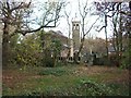

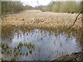
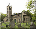
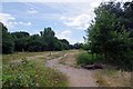

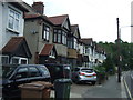
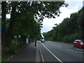

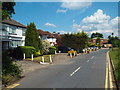
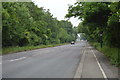
53 photos from this area
Area Information
Key information about the E18 2DY including its size, population, and administrative classification.
- Area Type
- Postcode
- Area Size
- 2.9 hectares
- Population
- 1658
- Population Density
- 5009 people/km²
House Prices in E18 2DY
40
Properties
£824,552
Average Sold Price
£103,000
Lowest Price
£1,942,000
Highest Price
Showing 40 properties
| Address | Type | Beds | Baths | Last Sale Price | Last Sale Date | |
|---|---|---|---|---|---|---|
| 66 Malford Grove, South Woodford, London, E18 2DY | Semi-detached | 4 | 2 | £1,600,000 | Oct 2024 | |
| 41 Malford Grove, South Woodford, London, E18 2DY | Semi-detached | 4 | - | £1,600,000 | Oct 2024 | |
| 47 Malford Grove, South Woodford, London, E18 2DY | Detached | 6 | 3 | £1,942,000 | Aug 2023 | |
| 57 Malford Grove, South Woodford, London, E18 2DY | Retail | 4 | 2 | £1,550,000 | Oct 2021 | |
| 63 Malford Grove, South Woodford, London, E18 2DY | Bungalow | - | - | £1,275,000 | Jun 2021 | |
| 76 Malford Grove, South Woodford, London, E18 2DY | Semi-detached | 4 | 1 | £1,230,000 | Jan 2021 | |
| 64 Malford Grove, South Woodford, London, E18 2DY | Detached | 5 | 3 | £1,190,000 | Mar 2016 | |
| 68 Malford Grove, South Woodford, London, E18 2DY | house | - | - | £985,000 | Feb 2016 | |
| 82 Malford Grove, South Woodford, London, E18 2DY | Semi-detached | 4 | 2 | £999,999 | Sep 2015 | |
| 70 Malford Grove, South Woodford, London, E18 2DY | Semi-detached | 5 | 1 | £975,000 | Aug 2015 |
Page 1 of 4
Energy Efficiency in E18 2DY
Amenities
Schools
| Rank | School | Type | Entry gender | Ages |
|---|
Explore more schools in this area
Go to Schools tabDemographics
Household Size
Family (3-5 people)
most common
Accommodation Type
Houses
most common
Tenure
68
majority
Ethnic Group
White
most common
Religion
N/A
most common
Household Composition
N/A
most common
Age
47
median
Adults (30-64 years)
most common
Household Deprivation
N/A
with no deprivation
NS-SEC
46
in Lower managerial occupations
Explore more demographic insights in this area
Go to Demographics tabPlanning
Planning Constraints
- Flood RiskPremium
- Ramsar Wetland SitesPremium
- Area of Outstanding Natural BeautyPremium
- Protected Nature ReservePremium
- Protected WoodlandPremium