Area Overview for E18 2DD
Photos of E18 2DD
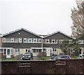
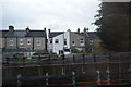
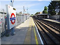
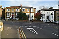
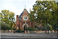
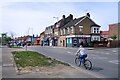
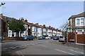
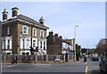
37 photos from this area
Area Information
Key information about the E18 2DD including its size, population, and administrative classification.
- Area Type
- Postcode
- Area Size
- 1.4 hectares
- Population
- 1658
- Population Density
- 5009 people/km²
House Prices in E18 2DD
32
Properties
£416,876
Average Sold Price
£105,000
Lowest Price
£692,000
Highest Price
Showing 32 properties
| Address | Type | Beds | Baths | Last Sale Price | Last Sale Date | |
|---|---|---|---|---|---|---|
| 17 Kingspark Court, South Woodford, London, E18 2DD | Terraced | 3 | 1 | £692,000 | Oct 2025 | |
| 12 Kingspark Court, South Woodford, London, E18 2DD | house | - | - | £610,000 | Jun 2021 | |
| 23 Kingspark Court, South Woodford, London, E18 2DD | house | - | - | £535,000 | Apr 2021 | |
| 7 Kingspark Court, South Woodford, London, E18 2DD | Terraced | 3 | 1 | £555,000 | Jan 2021 | |
| 2 Kingspark Court, South Woodford, London, E18 2DD | house | - | - | £530,000 | Apr 2020 | |
| 30 Kingspark Court, South Woodford, London, E18 2DD | Terraced | 3 | - | £500,000 | Jan 2020 | |
| 32 Kingspark Court, South Woodford, London, E18 2DD | house | 3 | 1 | £545,000 | Sep 2019 | |
| 18 Kingspark Court, South Woodford, London, E18 2DD | Terraced | 3 | - | £237,000 | Aug 2019 | |
| 19 Kingspark Court, South Woodford, London, E18 2DD | house | - | - | £300,000 | Mar 2017 | |
| 24 Kingspark Court, South Woodford, London, E18 2DD | house | - | - | £550,000 | Dec 2015 |
Page 1 of 4
Energy Efficiency in E18 2DD
Amenities
Schools
| Rank | School | Type | Entry gender | Ages |
|---|
Explore more schools in this area
Go to Schools tabDemographics
Household Size
Family (3-5 people)
most common
Accommodation Type
Houses
most common
Tenure
68
majority
Ethnic Group
White
most common
Religion
N/A
most common
Household Composition
N/A
most common
Age
47
median
Adults (30-64 years)
most common
Household Deprivation
N/A
with no deprivation
NS-SEC
46
in Lower managerial occupations
Explore more demographic insights in this area
Go to Demographics tabPlanning
Planning Constraints
- Flood RiskPremium
- Ramsar Wetland SitesPremium
- Area of Outstanding Natural BeautyPremium
- Protected Nature ReservePremium
- Protected WoodlandPremium