Area Overview for E18 1WB
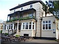
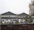
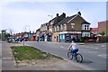
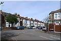
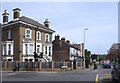
Photos of E18 1WB


Area Information
E18 1WB is a small residential postcode in England, home to 2105 residents spread across a compact cluster of properties. This area is defined by its modest scale and practical layout, offering a quiet alternative to larger urban centres. The community here is predominantly composed of adults aged 30–64, with a median age of 47, suggesting a stable, mature demographic. Most homes are flats, reflecting a housing stock tailored to established residents rather than families with young children. Daily life in E18 1WB balances proximity to essential services with a low-key, low-risk environment. The area’s safety profile is strong, with a crime risk score of 78/100—well below average—making it appealing for those prioritising security. Nearby, residents have access to multiple train stations, supermarkets, and even London City Airport, ensuring connectivity without the chaos of a dense metropolis. While the area lacks natural or historical landmarks, its straightforward infrastructure and reliable amenities make it a pragmatic choice for buyers seeking a secure, functional living space.
- Area Type
- Postcode
- Area Size
- Not available
- Population
- 2105
- Population Density
- 3960 people/km²
The property market in E18 1WB is characterised by a high proportion of flats, with 54% of homes owned by residents rather than rented. This suggests a balance between owner-occupation and rental availability, though the small scale of the area may limit the variety of housing options. The dominance of flats indicates a focus on practical, space-efficient living, likely catering to older adults or professionals who prefer minimal upkeep. Buyers considering this area should note its compact nature—while the postcode covers a small cluster of properties, the immediate surroundings offer limited scope for expansion or development. The flat-dominated market may also mean fewer family-sized homes, making it less suitable for growing households. However, the low crime risk and proximity to transport links could offset the lack of architectural diversity, appealing to those seeking a secure, low-maintenance base in a functional urban setting.
House Prices in E18 1WB
No properties found in this postcode.
Energy Efficiency in E18 1WB
Living in E18 1WB grants access to a range of practical amenities within walking or short transit distance. Retail options include Co-op South, Sainsburys South, and Tesco Woodford, ensuring daily shopping needs are met. The area’s transport links are its strongest asset, with five train stations—South Woodford, Snaresbrook, and Wanstead among them—offering frequent services to London’s core. Nearby, the Whipps Cross Bus Interchange connects to broader regional routes, while proximity to London City Airport provides an alternative for travel. For leisure, the area is close to East India Pier and North Greenwich Pier, though these are more distant. While the number of parks or recreational spaces is not specified, the presence of multiple transport hubs and retail outlets suggests a lifestyle focused on convenience rather than expansive leisure opportunities. This makes E18 1WB ideal for those prioritising accessibility over sprawling green spaces.
Amenities
Schools
| Rank | School | Type | Entry gender | Ages |
|---|
Explore more schools in this area
Go to Schools tabDemographics
The population of E18 1WB is predominantly adults, with 30–64-year-olds forming the most common age group. The median age of 47 indicates a community of established professionals and families, rather than a younger, transient demographic. Home ownership here stands at 54%, slightly below the national average, suggesting a mix of owner-occupied properties and rental units. The accommodation type is almost entirely flats, which aligns with the area’s compact footprint and may reflect a preference for low-maintenance housing. The predominant ethnic group is White, though specific diversity statistics are not provided. With no data on deprivation levels, it is unclear how economic factors influence quality of life, but the low crime risk and access to retail and transport suggest a reasonably stable environment. This profile paints a picture of a mature, functional community where residents prioritise security and convenience over novelty or expansion.
Household Size
Accommodation Type
Tenure
Ethnic Group
Religion
Household Composition
Age
Household Deprivation
NS-SEC
Explore more demographic insights in this area
Go to Demographics tabPlanning
Planning Constraints
- Flood RiskPremium
- Ramsar Wetland SitesPremium
- Area of Outstanding Natural BeautyPremium
- Protected Nature ReservePremium
- Protected WoodlandPremium